
Figures & data
Figure 1. (a) Location map of the study area in Southern Italy; (b) satellite image of Gargano promontory’s coast (ESRI Satellite, World Imagery). In the red zoomed box, there is the orthophoto image of the Tremiti Islands (Puglia Region, http://www.sit.puglia.it).
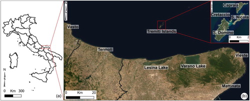
Table 1. Specific geomorphological issues for each working group.
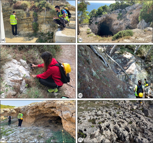
Figure 2. Photo documentation of geomorphological field activities: (a) detail of field work at I Pagliai; (b) karst depression on the calcareous bedrock; (c) detail of geomechanical investigations at Cala degli Inglesi; (d) V-shaped gully interrupted by artificial wooden barriers, at Cala Matano; (e) emerged karst cave at Cala della Tramontana; (f) dolomitic limestone outcropping at Punta Secca.
Supplemental material