Figures & data
Figure 1. Location map of the Cinque Terre national Park (CTNP).
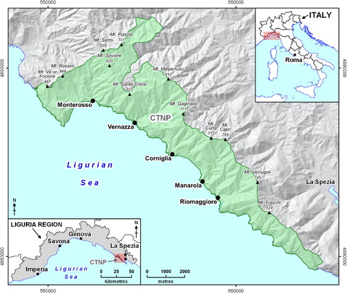
Table 1. List of cartographic data used in this research.
Figure 2. Examples of typical landslides in the CTNP. (a) Planar slides and falls involving sedimentary rock masses along the coast west of the Vernazza village; (b) slope instability affecting a road cut along the provincial road n° 51 in the upper sector of the Vernazza catchment; (c) rainfall-induced shallow landslides triggered on abandoned terraced slopes at Vernazza (modified from CitationCevasco et al. 2012); (d) frontal view of the ancient Guvano landslide body, whose toe is currently undermined by marine erosion; (e) active escarpment edges at the headland of Punta Merlino.
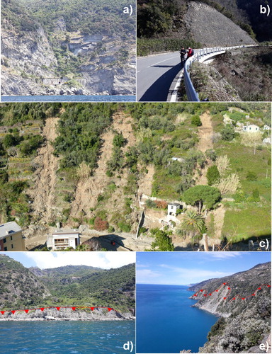
Figure 3. (a) Valleys-related geomorphologically homogeneous sectors of the CTNP; (b) example of V-shaped valley upstream of Monterosso; (c) an example of very steep channel head at Mt. Pizzolo, Vara Catchment; (d) bedrock channel presenting rock steps and plunge pools in the Pastanelli Creek Catchment; (e) typical confined semi-alluvial channel of the main valleys characterized by widespread bedrock outcrops and coarse sediments, Vernazza Creek upstream of Vernazza; (f) reworked eluvial-colluvial deposits behind a collapsed dry-stone wall at Manarola.
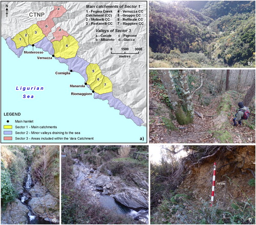
Figure 4. Examples of typical coastal landforms and deposits in the CTNP: (a) plunging cliff at the Corniglia headland (photo from CitationRegione Liguria, 2020b); (b) active cliff at the base of coastal terraced slopes affected by intense erosional processes and mass movements along the coast east of Schiara; (c) beach fed by the Pastanelli Creek at the Monterosso hamlet (photo from CitationRegione Liguria, 2020b); (d) active edge of a retreating cliff affecting an hiking coastal trail at the headland of Punta del Persico.
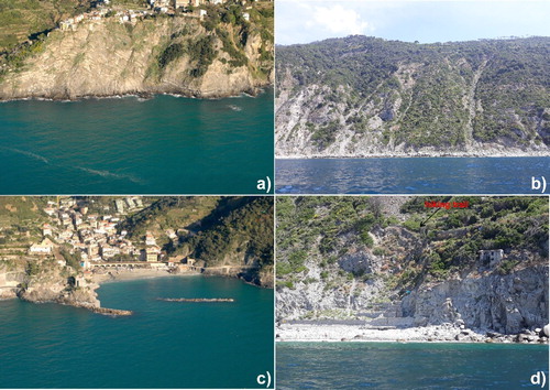
Figure 5. (a) Plot showing the percentage of CTNP territory occupied by terraced areas (TA); (b) land use/land cover of terraced areas.
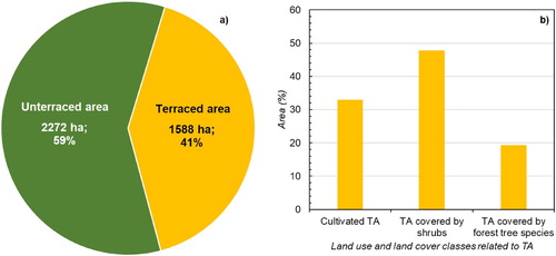
Figure 6. Examples of terraced areas in the CTNP. (a, b) Examples of cultivated vineyards at Vernazza; (c) terraced areas covered by shrubs surrounded by cultivated vineyards along the slopes in back of the Manarola village; (d) detailed view of terraced areas covered by shrubs showing dry-stone walls partially collapsed along the coastal slopes east of Riomaggiore; (e) terraced areas covered by forest tree species and cultivated vineyards along the coastal slopes east of Corniglia; (f) example of dry-stone walls in a terraced area covered by forest tree species in the proximity of Fossola.
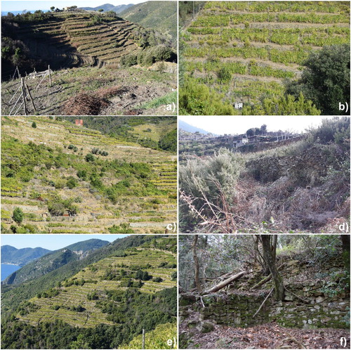
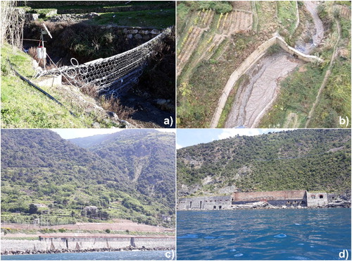
Figure 7. Geo-hydrological risk mitigation measures and engineering works in the CTNP: (a) debris flow barrier along the Vernazza Creek, at the Vernazzola area; (b) selective concrete check-dam along the Vernazza Creek, at the Vernazzola area; (c, d) railway embankments at the Macereto area (east of Vernazza) and at the Rodalabia area (east of Corniglia), respectively.