Figures & data
Figure 1. (a) Location map and geological scheme of Spitzbergen (Svalbard, Norway) (modified from CitationHjelle 1993). (b) Location map of the study areas (black boxes) in the Kongsfjorden (Svalbard, Norway); base data from Norwegian Polan Institute (https://geodata.npolar.no/).
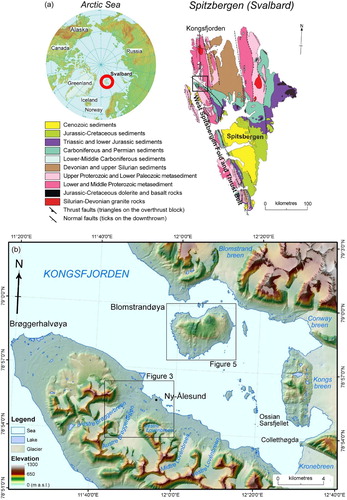
Figure 2. Geometrical calculation of the fan-shaped landforms thickness. H max: max thickness; α: slope angle of the lower part of the slope; α’: slope angle of the upper rock slope.
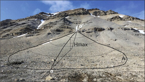
Table 1. Images and terrain-surface models used in this work and related sources.
Table 2. Fan-shaped landforms and talus slopes on (a) Zeppelinfjellet slope (Ny-Ålesund).
Table 3. Fan-shaped landforms and talus slopes on Bratliekollen slope (Blomstrandøya).
Figure 3. Orographic and hydrographic features of the Ny-Ålesund area (location in ); base data data from Norwegian Polan Institute (https://geodata.npolar.no/).. (a) Elevation distribution and hydrography; (b) Slope distribution.
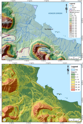
Figure 4. Quaternary deposits and landforms of the Ny-Ålesund area. (a) Terminal (T), lateral (L), and ground (G) moraines of Vestre Brøggerbreen; in the background talus cones (Tc) on the slope of Zeteligfjellet; (b) Terminal moraine (T) of the Vestre and Midtre Lovénbreen and braided channel (Bc) of the glacial outwash (Wexelva); (c) Periglacial patterned ground on the Bayelva area; (d) Talus cones (Tc) affecting the structural scarps and ridges on the slopes of Zeppelinfjellet, at the base of the slope a rockglacier (Rg) and in the foreground the moraine (L, lateral; G, ground; T, terminal) system of the Austre Brøggerbreen; (e) Bayelva braided channel (Bc) and fluvial deposits in the Vestre Brøggerbreen and Austre Brøggerbreen glacier outwash; (f) Fluvial erosion scarps affecting the bedrock northern tributary of Bayelva; (g) Coastal cliff affecting the Kolhamna coast (airport area).
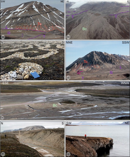
Figure 5. Orographic and hydrographic features of the Blomstrandøya area (location in ); base data from Norwegian Polan Institute (https://geodata.npolar.no/). (a) Elevation distribution and hydrography; (b) Slope distribution.
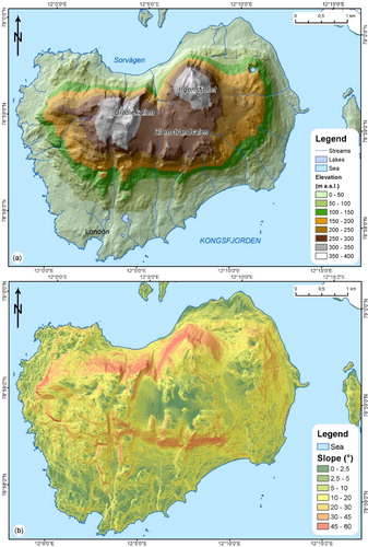
Figure 6. Quaternary deposits and landforms of the Blomstrandøya area. (a) Recessional moraine (R) related to the retreat of Blomstrandbreen in the NE side of the island (CitationBurton et al. 2016); (b) Wide areas affected by periglacial patterned ground and solifluction evidences (on the flat summit area); (c) Rock fall (Rf)and talus cone (Tc) in the western scarp of the island; (d) Roche moutonnée on marble bedrock outlining W- to WNW-flow (SW side of the island); (e) Erratic boulder (arrow) on one of the top ridges of the island at ∼170 m a.s.l.; (f) Steep rock wall on the side of the main ridges of the island (Bratliekollen, northern side of the island); (g) Coastal cliffs and caves affecting the marble rocks (western side of the island).
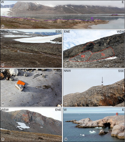
Figure 7. Panoramic view of the Zeppelinfjellet rock slope: (a) NE side, (b) NW side.
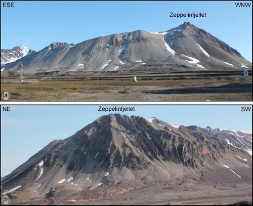
Figure 8. Panoramic view of the Irgensfjellet (a) and Bratliekollen (b) rock slopes.
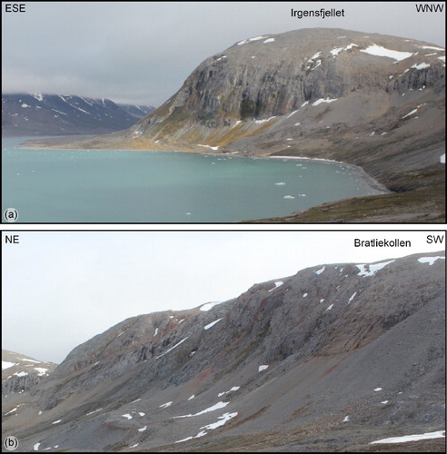
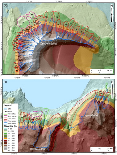
Figure 9. Fan-shaped landforms and talus slopes distribution on (a) Zeppelinfjellet slope (Ny-Ålesund) and (b) Bratliekollen slope (Blomstrandøya); the numbers refer to and .