984
Views
6
CrossRef citations to date
0
Altmetric
Social Science

Mapping topo-ambivalent places for the purposes of strategic planning of urban space. The case of Šternberk, the Czech Republic

, ORCID Icon & ORCID Icon
Pages 203-209 | Received 14 Jan 2020, Accepted 23 Oct 2020, Published online: 02 Dec 2020

Figures & data

Table 1. Socio-demographic profiles of the research sample and the population of the town aged 15 years and higher (%) and χ2 test results.

Figure 1. Particular methods used for the identification of topo-ambivalent places. Source: authors’ design.

Figure 1. Particular methods used for the identification of topo-ambivalent places. Source: authors’ design.

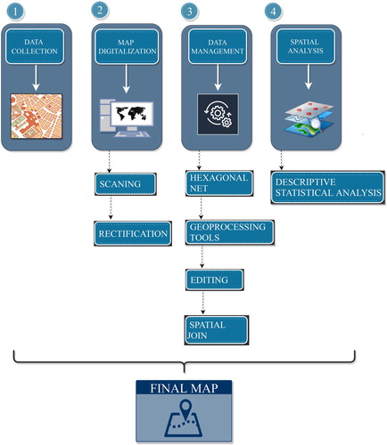
Table 2. Topo-ambivalent places in the town of Šternberk and the most frequent feelings that residents had towards them.

Supplemental material

Revised_Main_map.pdf

Download PDF (28.1 MB)