
Figures & data
Figure 1. Estimated crime density for the five main types of events, for 2015–2019.
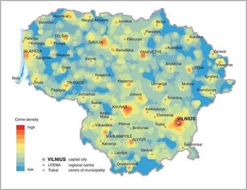
Figure 2. Dynamics of crime events in 2015–2019.
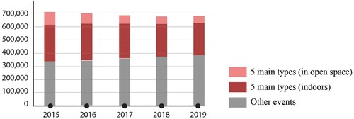
Figure 3. Dynamics of crime events in open space, number of incidents.
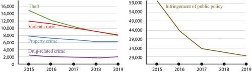
Figure 4. Structure of crime events, average for 2015–2019.
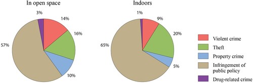
Figure 5. Crime events in very sparsely populated cells (average for 2015–2019).
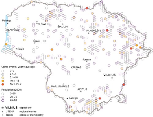
Table 1. Estimation of types of dynamics for the cell Ci.
Figure 6. Estimated log-transformed relative risk surface, 2015–2019.
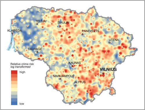
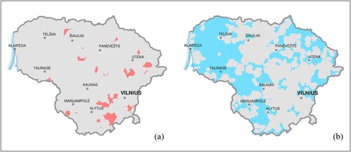
Figure 7. (a) high relative risk areas (p ≤ .05); (b) low relative risk areas (p ≤ .05).
MapPoster_20210916.pdf
Download PDF (17.2 MB)Data availability statement
The spatial data used in this study have been generated from original event point data via aggregation into a hexagonal lattice. Precise point data on crime are sensitive and cannot be made publicly available. Aggregated data have been published online to provide possibilities for interactive access, viewing and analysis of the data in different aspects. The data have been published as a feature service using the ArcGIS online platform. This service can be further used in combination with other spatial data, as a thematic layer in applications and in decision making tools or for direct access to the data.
An operational dashboard has been constructed, that provides a glimpse into spatial distribution and main statistics of crime events and their layers. The dashboard can be used for simple territorial analysis. This method of publishing data online is based on technological architecture that can be used to update the data most efficiently and in a way that ensures continuity for data service or operational dashboard users.
Online data and relevant information are available at https://lietuvoskartografija.lt/mokslas-visiems/scientific-publications-projects/spatial-distribution-of-criminal-events-over-lithuania-in-2015–2019.