
Figures & data
Figure 1. Sardinia Island. (A) Satellite view of the Mediterranean region where Sardinia occupies a central position. Dashed line indicates the Sardinia anticlockwise rotation occurred in the Neogene time. A read * is point at the Asinara Island (source of the picture is Google Earth); (B) Digital terrain model of Sardinia; in the map are reported the main cities. In the square, the Asinara Island studied area. Abbrevitions: BI = Balearic Islands; lp = Liguro-Provençal Basin; Ty = Tyrrhenian Sea. C) The Asinara Isla (nd). In the picture are indicated the limit and zones, with different degrees of environmental protection of the Marine Protected Area: (red line) no-entry no-take (Zones A); (yellow line) general reserve (Zone B), and (withe line) partial reserve (Zone C) (source of the picture is Ortophoto 2008-Regione Sardegna, RAS).
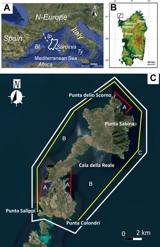
Figure 2. (A) Side Scan Sonar (SSS) sea floor mosaic of the Asinara Island (modified after CitationRomeo et al., Citation2019). Dashed lines indicate the 21 ROV transects, red and black spots the extrapolated transects; (B) Detail of the SSS mosaic relative to the western side of the island. Note that lower backscatter (Lb) dominates the narrow areas in front of the gravelly pocket beaches, whereas the higher backscatter (Hb) dominates the deepest part of the shelf. Pr = pre-Coralligenous, Cr = Coralligenous; (C) Detail of the SSS mosaic of the Cala della Reale embayment. Note the quasi-circular clearing (Cl) interrupting the continuity of the Posidonia oceanica meadow (patchy backscatter = Pb); I = channels, s = spot of Biocenosis at Holothuria sp. Codium bursa Feoficee. (D) Detail of the SSS mosaic in front of P.ta Sabina. Pb = P.oceanica patchy backscatter, Lb = fine sand lower backscatter, Ab = alternate high and low backscatter relative to the dune field (D). The dune field is NNE-SSW oriented.
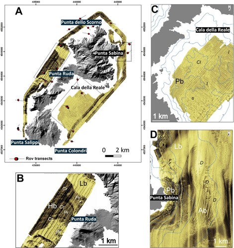
Figure 3. High Resolution swath bathymetric map (Multi Beam) of the Marine Protected Area of the Asinara Island. Arrows indicate the channels of the Cala della Reale emabyment; cl = quasi-circular, funnel shaped clearing, br = beachrocks, D = Dune field (Modified after CitationRomeo et al., Citation2019).
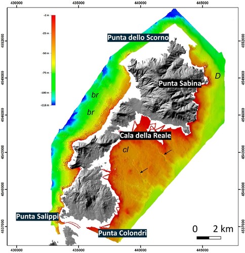
Figure 4. Biocenosis of the upper infralittoral rock in sheltered waters. (A) Lithophyllum byssoides (Lamarck) Foslie and (B) Patella ferruginea (Gmelin).
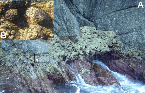
Figure 5. Coralligenous reefs. In the pictures are visible the following species: Lithophyllum sp., Mesophillum sp. Peyssonnelia rubra (Gmelin), Flabelia petiolata (Turra) Nizamuddin, Peyssonnelia squamaria (S. G. Gmelin) Decaisne, Osmundaria volubilis (L.) R.E. Norris and colonies of Eunicella cavolinii. The two red dots distance is 10 cm.
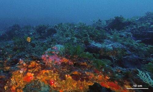
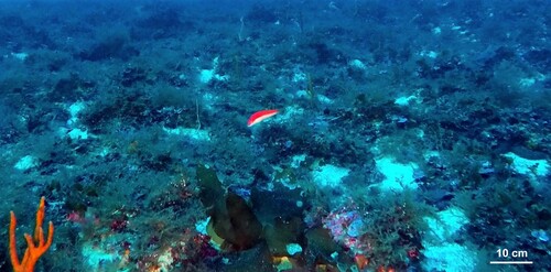
Figure 6. The Laminaria rodriguezii Bornet.
TJOM_A_2052765_supplementary material
Download PDF (31.2 MB)TJOM_A_2052765_Supplementary Map
Download PDF (31.6 MB)Data availability statement (DAS)
All the data used to realize the Sea Floor Map of the Asinara Island are property of the National Park of the Asinara Island. They could be requested directly to the park writing at [email protected], or visiting the website http://www.parcoasinara.org/