
Figures & data
Figure 1. Position and the geological map of the Nízký Jeseník Upland.
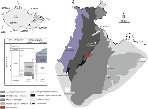
Figure 2. Types of mines detected in the investigated area.
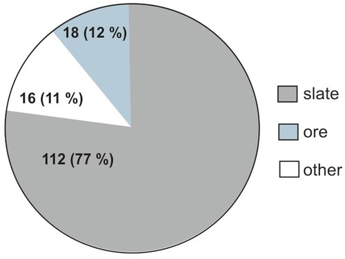
Figure 3. Illustrative example of mapping and map processing, the Dřevěná štola slate mine.
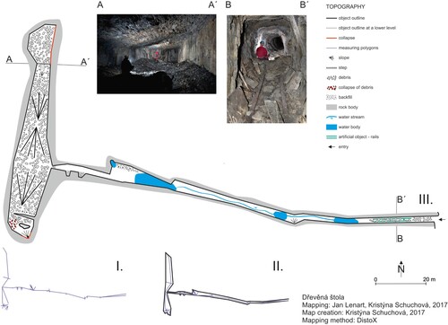
Table 1. Numbers of mines with detected parameters classified according to their length and numerical intensity index.
Table 2. Statistical comparison between explained and explanatory variables: (–) not statistically dependent or probable, (0) unproven linkages, (*) weakly conclusive linkages, (**) moderately conclusive linkages, (***) strongly conclusive linkages.
Supplemental Material
Download Zip (1.6 MB)Data availability statement
The authors confirm that the data supporting the findings of this study are available within the article and its supplementary materials. Maps of the mines are available from the corresponding author, Jan Lenart, [email protected], upon reasonable request.