
Figures & data
Figure 1. Geological and geomorphological map of the study area (after CitationAscione et al., 2020).
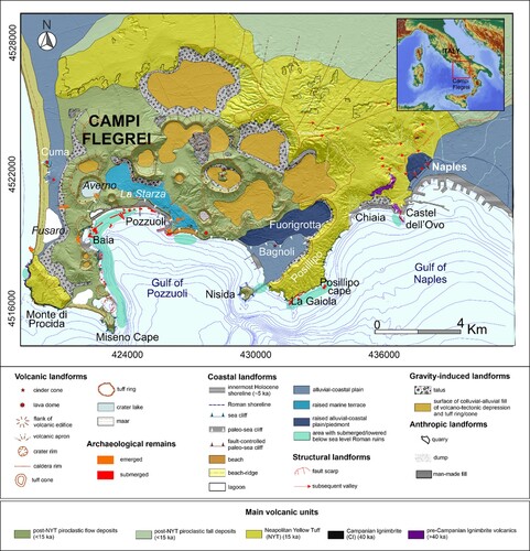
Figure 2. A. Map of the study area with the distribution of the different surveys carried out along each coastal sector with archaeological structures.
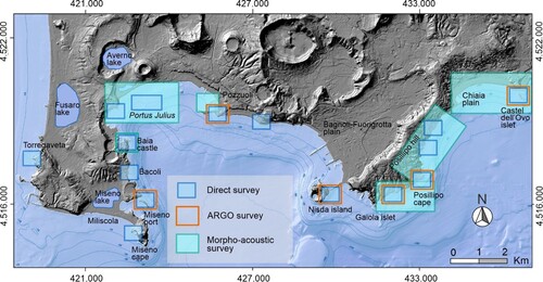
Figure 3. Photos of: A) Argo marine drone in action during a survey performed along the coastal sector around Castel dell’ Ovo; B) SSS transducer during the survey at Baia; C) Borehole drilled at Pozzuoli; D) Direct survey at Portus Julius.
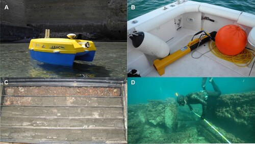
Table 1. List of sea-level markers (SLMs) identified in the study area: SLM type (sea-level index point – SLIP or terrestrial limiting point – TLP; column 1); interpreted archaeological feature (column 2); Functional clearance (FC expressed in meters; column 3); Indicative Range (mean high water – MHW, mean low water – MLW, medium sea level – MSL; column 4); Examples of different markers identified through their ID-number which pictures are presented in the main maps (Map 1 – from Fusaro Lake to Nisida, and Map 2 – from Nisida to Municipio Plain; column 5).
Table 2. Sea-level markers (SLMs) identified in the coastal sector ranging from Fusaro Lake to Miseno Cape: SLM ID (column 1); Age (expressed in ka BP, column 2); SLM type (sea-level index point – SLIP or terrestrial limiting point – TLP; column 3); interpreted archaeological feature (column 4); RSL and related uncertainty (expressed in meters, column 5); vertical displacement and related uncertainty (VD; expressed in meters, column 6); Source (column 7). Data from CitationMattei et al., 2022.
Table 3. Sea−level markers (SLMs) identified in the coastal sector ranging from Miseno Cape to Nisida: SLM ID (column 1); Age (expressed in ka BP, column 2); SLM type (sea−level index point − SLIP or terrestrial limiting point − TLP; column 3); interpreted archaeological feature (column 4); RSL and related uncertainty (expressed in meters, column 5); vertical displacement and related uncertainty (VD; expressed in meters, column 6); Source (column 7). Data from CitationMattei et al., 2022.
Table 4. Sea−level markers (SLMs) identified in the coastal sector ranging from Nisida to Municipio coastal plain: SLM ID (column 1); Age (expressed in ka BP, column 2); SLM type (sea−level index point − SLIP or terrestrial limiting point − TLP; column 3); interpreted archaeological feature (column 4); RSL and related uncertainty (expressed in meters, column 5); vertical displacement and related uncertainty (VD; expressed in meters, column 6); Source (column 7). Data from CitationMattei et al., 2022.
Figure 4. A. Semi-submerged archaeological remains of Vatia Villa at Torregaveta; B. detail of the fish-tank complex remains at Lucullus Villa along the western side of Miseno Cape; C. View from the south of Torregaveta Promontory; D. View of the sea cliffs of Monte di Procida.
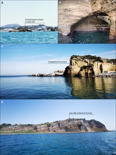
Figure 5. A. The southern side of the Island of Punta Pennata and one of the three Roman tunnels that pass through it; B. View from the north of Baia Castle; C. View from the south of Punta Epitaffio; D. View from the sea of Rione Terra in Pozzuoli.
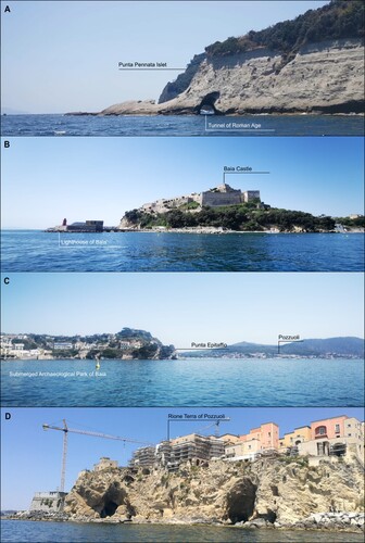
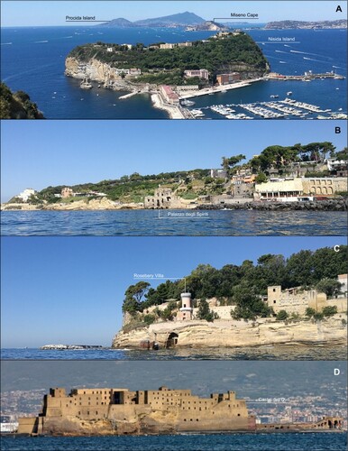
Figure 6. A. View from NE of Nisida Island; B. View from the sea of Posillipo coast with the famous palazzo degli Spiriti in the center; C. View from the sea of Posillipo sea cliffs with part of Rosebery Villa built on the top; D. View from the sea of Castel dell’ Ovo.
Supplemental Material
Download Zip (282.8 MB)Data availability statement
Data available within the article or its supplementary materials.