
Figures & data
Table 1. Photographed sign attributes and their values identified for LingGIS.
Figure 1. The main interface of the LingGIS web experience as viewed on 1280 × 800 monitor (above), 601 × 962 tablet (left), and 360 × 640 phone (right) screens.
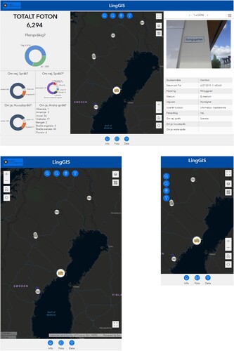
Figure 2. The survey widget, Foto, lets users locate and upload photos and their linguistic and contextual attributes to an ArcGIS Survey123 dataset.
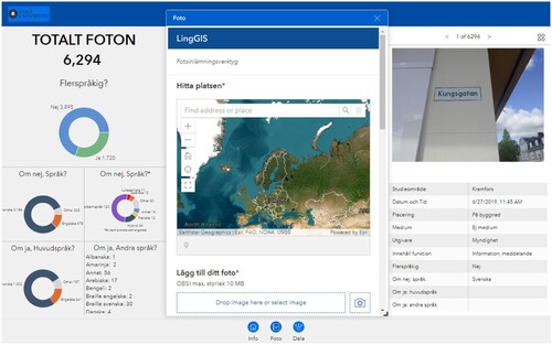
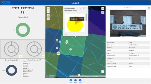
Figure 3. A snapshot of the LingGIS web experience, indicating some correlation between the use of Finnish as secondary language and the relatively high presence of residents born in a Nordic country other than Sweden in the Swedish town of Pajala, bordering Finland.
Data availability statement
The data is publicly available at https://www.arcgis.com/home/item.html?id=32829361537e49aab0a6b4c54e545f4b#data