Figures & data
Figure 4. Group of tourists trekking in the trail section Paine Grande – Italiano ranger station.
Source: CONAF.
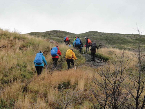
Figure 1. Cuernos del Paine from Toro lake.
Source: José Barrena.
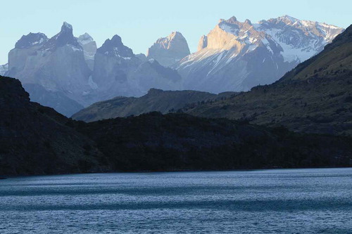
Figure 2. Protected Areas in the Region of Magallanes and Chilean Antarctica. (a) Shows public and private protected areas in Southern Patagonia. (b) Shows the National Park Torres del Paine and the projected expansion of the Biosphere Reserve Site, including core (public protected areas), buffer and transition zones. (c) Shows Chilean Southern Patagonia in South America.
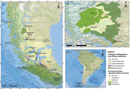
Figure 3. National Park Torres del Paine. The dark green strip that is observed towards the East and South of the rock formations bordering the Nordernskjöld Lake correspond to the Reserva Cerro Paine.
Source: CONAF.