Figures & data
Figure 1. The spatial logic of a summer farm and the example of the Bastberget summer farm in an orthophoto and from the ground.
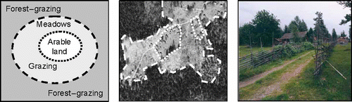
Figure 2. Two different knowledge processes: the human, mental interpretation of a landscape scene on the left and machine-based numerical clustering and segmentation on the right.
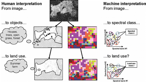
Figure 3. An outline of the suggested absolute/relational classification and conceptual space representation. The human (H1–2) and machine knowledge elements (M1–7) are combined to produce a resulting proxy image for land use.
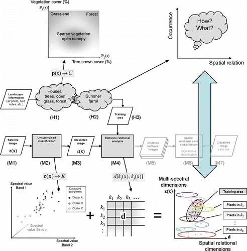
Figure 4. A map showing the location of the three different types of summer farms in the study area, and the result from the SRPC process overlaid on a b/w orthophoto, with the yellow color tone on developed areas and the green tone on other land. Type-1: In use; Type-2: Recently abandoned; Type-3: Overgrown.
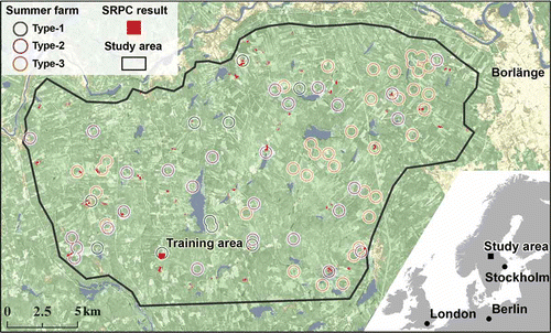
Figure 5. A summary assessment of the SRPC classification illustrating the number of correct identifications of the known locations of summer farms Types 1–3 and the number of non-identified locations.
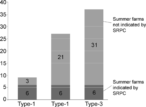
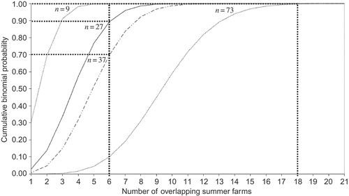
Figure 6. Cumulative binominal distributions for n = 9, 27,37, and 73 randomly placed buffer overlaps corresponding to the number of reference farms of type 1, 2, 3, and all types respectively.