Figures & data
Figure 1. (a) Location map of study area. (b) Land use categories, 1987. (c) Land use categories, 2002. (d) Land use categories, 2013.
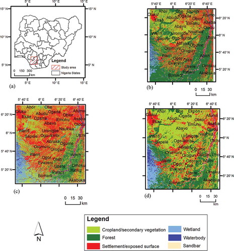
Table 1. Error matrix.
Table 2. Accuracy assessment.
Table 3. Land use/cover gain/loss analysis.
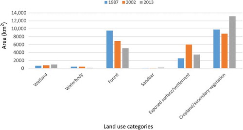
Figure 2. Land use/cover gain/loss between 1987 and 2013.