
Figures & data
Table 1. Land tenure diversity in Acre, Brazil, 2006.
Figure 1. Map of households and communities visited in lands with distinct tenure rules along the Inter-Oceanic Highway in Eastern Acre, Brazil, 2008–2009.
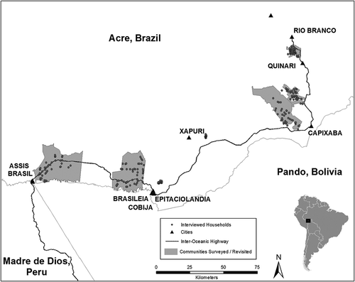
Table 2. Descriptive statistics for tenure formalization and its consequences, in agricultural projects and agro-extractive projects, Acre, Brazil, 2009.
Table 3. Descriptive statistics for determinants of tenure formalization and its consequences, in agricultural projects and agro-extractive projects, Acre, Brazil, 2009.
Table 4. Ordered logit models of formalization (Land Titles), Households in agricultural projects and agro-extractive projects, Acre, Brazil, 2009.
Table 5. Binary logit models of formal bank credit, households in agricultural projects and agro-extractive projects, Acre, Brazil, 2009.
Table 6. Tobit models of the castanha harvest, households in agricultural projects and agro-extractive projects, Acre, Brazil, 2009.
Table 7. Weighted least squares models of cattle pasture, households in agricultural projects and agro-extractive projects, Acre, Brazil, 2009.
Table 8. Weighted least squares models of tree crops, households in agricultural projects and agro-extractive projects, Acre, Brazil, 2009.