Figures & data
Table 1. Satellite imagery used to map current land use and as a basis for the participatory mapping workshops.
Figure 1. Overview of the mapped case study landscapes in the three study regions in Madagascar, Myanmar, and Laos, with tree cover in the year 2000 (Hansen et al., Citation2013) to illustrate the humid tropical forest frontier context.
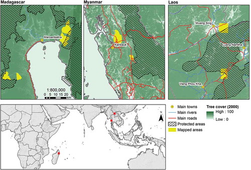
Figure 2. Methodological overview of the proposed mapping approach, with dashed lines indicating participatory components. GIS = geographic information system.
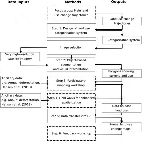
Table 2. Overview of methods applied in the different countries and case study landscapes.
Figure 3. Implementation of the participatory mapping workshops and field walks in (a) Madagascar, (b) Laos, and (c) Myanmar.
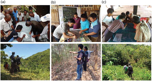
Table 3. Total number of polygons, average size of polygons, and overall area mapped per case study landscape.
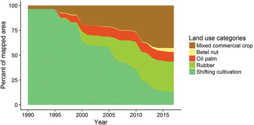
Figure 4. Land use transitions in Hein Ze (Myanmar) from 1990 to 2017, shown as changes in the shares of the different land uses in the overall landscape (1,431 ha) over time.