Figures & data
Figure 1. Yucatan Peninsula, Mexico: the Chenes and Calakmul study areas, the location of Elizondo and López Merlín (Citation2009) study, and the approximate extent of fundos legales (periurban multiuse forest reserves, sensu Levy Tacher et al., Citation2016). Land cover classes based on ‘tree cover’ layer in Hansen et al. (Citation2013), ‘intact forest landscape’ layer in Greenpeace (Citation2013), and author’s interpretation of 2018 LANDSAT imagery.
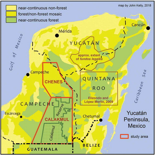
Table 1. Frequency of village-scale reserve types in study communities, as documented in semi-structured, sketch-map-facilitated group interviews. DAVFR = deliberate, autochthonous, village-scale forest reserve. GCR = government-certified reserve.
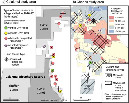
Figure 2. (a) Village-scale reserve types in the Calakmul study area; (b) Village-scale reserve types, land tenure classes, and forest cover change (2000–2010) in the Chenes study area. DAVFR = deliberate, autochthonous, village-scale forest reserve.