Figures & data
Table 1. Sources and main uses of data used in this study
Figure 1. Study area and spatial distribution of different types of data used in this research: (a) land use, (b) spatial location, (c) elevation, (d) soil type, (e) farmland quality, and (f) point of interest (POI). Note. PSO: paddy soil; BLPSO: bleached paddy soil; PPSO: percogenic paddy soil; DPSO: degleyed paddy soil; ML: medium loam; BRRSO: brown-red soil; RSO: red soil; ALLSO: alluvial soil; YCSO: yellow-cinnamon soil; CLPYCSO: clay pan yellow-cinnamon soil; FLAGUSO: fluvo-aquic soil; BSO: bog soil; YBOSO: yellow-brown soil; ACSKSO: acid skeletal soil; SKSO: skeletal soil; TF: terra fusca.
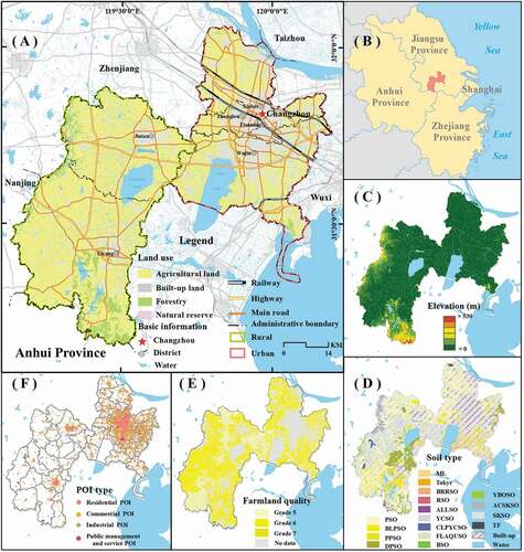
Figure 2. Technological flow of land-type classifications and spatial planning zoning.
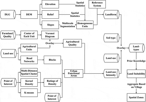
Table 2. Terrain factors and their mathematical expressions
Figure 3. Differences between land zoning based on land-types and spatial planning systems.
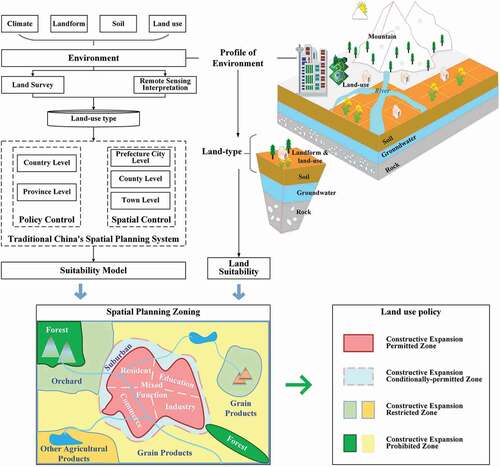
Table 3. Generalization rules of land suitability based on land-types
Figure 4. Land-type map of Changzhou City (detailed information of legend is showed in the Appendix).
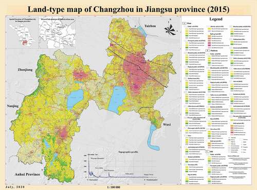
Figure 5. Proportions of land-types in Changzhou City. (a) Proportion of Level 2 land-types. (b) Proportion of land-use types. (c) Agricultural land quality of different soil types. (d) Proportion of urban functional areas in different buffer areas.
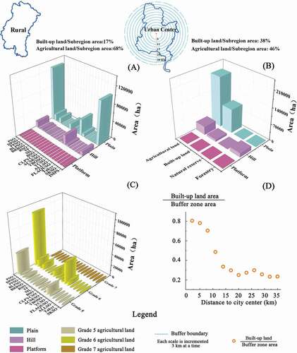
Figure 6. Spatial planning zoning map of Changzhou City.
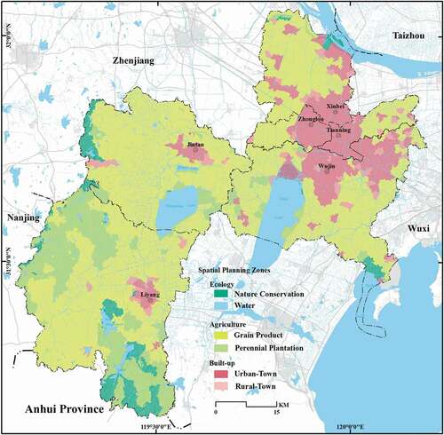
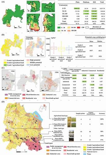
Figure 7. Accuracy of land-types. (a) Accuracy of landform classification. (b) Accuracy of agricultural land quality. (c) Accuracy of urban functional areas. (d) Accuracy assessment based on typical land-type points.