Figures & data
Figure 1. Study research contexts mapped
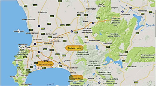
Figure 2. Pictures depicting the safe natural spaces in children’s communities, such as school gardens (top left, Mitchell’s Plain), the nearby beach (top right, Gordon’s Bay), the park (bottom left, Mitchell’s Plain), and their school grounds (bottom right, Stellenbosch).
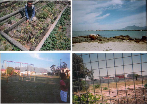
Figure 3. This intricate map was sketched by a male participant from Gordon’s Bay, showing his excellent attention to detail and knowledge of his neighbourhood, particularly natural places.
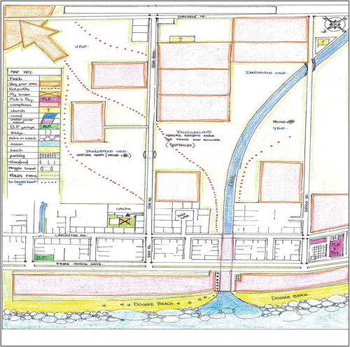
Figure 4. Photographs showing the unsafe spaces in children’s communities. In particular, we see a littered field (where the potential for children being assaulted or kidnapped is high), open green space which children are unable to access, and ‘wild’ nature (evident in the picture with the baboon).
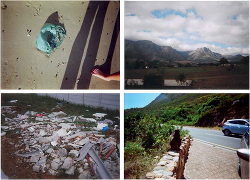
Figure 5. In Map 3, we can see that there are only two safe spaces for this participant: her house and her friend’s house (demonstrated by the gold stars). It is also evident that the parks, the roads, and the beach, which are all spaces surrounding and close to home, are all unsafe (indicated by the red dots).
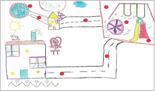
Figure 6. Map 4 shows a predominance of unsafe spaces for this participant, including known drug houses, the beach, the field close to home, and outside the church. Similar to the other maps, the school, soccer field, and mosque were identified as safe.
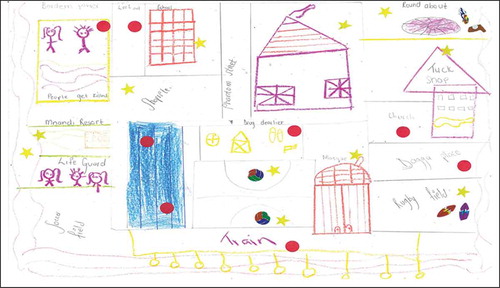
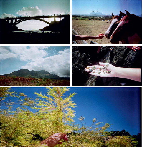
Figure 7. From the photographs, we can see that a picturesque river with a bridge, and being close to fauna (starfish, feeding horses, and chameleon, bottom) are among children’s favourite places in nature.