Figures & data
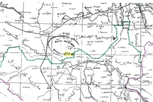
Figure 1. Rueng Dinka sections (Sudan Survey Department, 1:2,000,000 Map Sudan Tribes Sheet 3, 1956). The highlighted dashed line shows the provincial boundary. The heavy black broken line represents an alleged dividing line between Arab and African peoples.
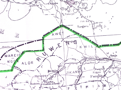
Figure 2. Kordofan–Upper Nile Province 1931 boundary line (Sudan Survey 1:250,000 maps 65-H (May 1937) and 65-L (June 1936) from digital copies provided by the Bodleian Library, University of Oxford).
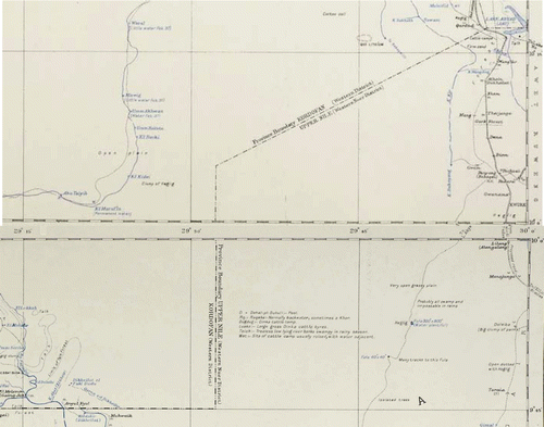
Figure 3. Nafie Ali Nafie's 2004 Map.