Figures & data
Figure 1. Architecture of a spatial decision support system (SDSS) (modified from Leung, Citation1997).
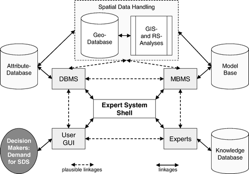
Figure 2. Structure of a spatial environmental information system (SEIS).
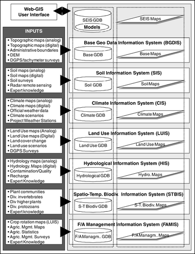
Figure 3. Model integration into the GIS-based soil-land use-system approach (modified from Bareth Citation2005).
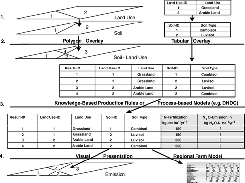
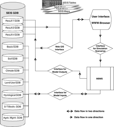
Figure 4. Interfaces and data flow for model integration into a SEIS.