Figures & data
Figure 1. Earthquake-affected area of the Sichuan province north of Chengdu. The location of the epicentre (star) as well as the three towns included in the study are shown.
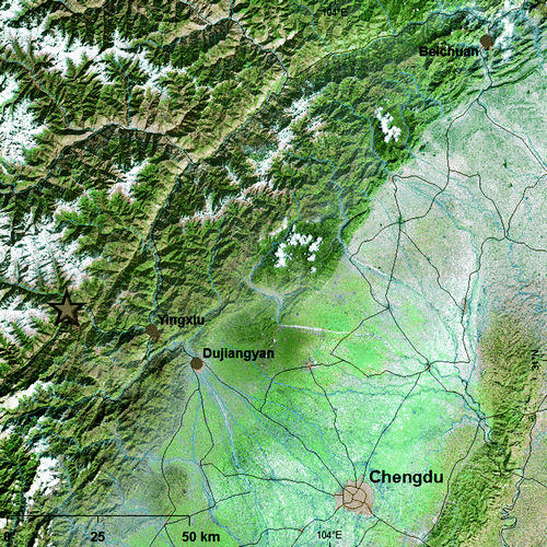
Table 1. Imagery used for structural damage assessment in areas affected by the Sichuan earthquake.
Table 2. Optical satellite imagery potentially useful for post-disaster damage assessment presented in the order of decreasing resolution. Imagery used in this study are given in italics.
Table 3. Images from satellite-borne synthetic aperture radar (SAR) sensors. Imagery used in this study are given in italics.
Figure 2. A 1×1 km2 subset of the city of Yingxiu as seen by WorldView-1 (a). The highlighted central area is enlarged in (b).
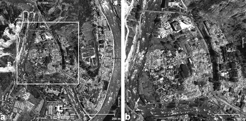
Figure 3. A comparison of CosmoSkymed SAR stripmap data at 3 m resolution (a) and SPOT-5 pre-disaster panchromatic imagery at 2.5 m pixel spacing (b) over Yingxiu.
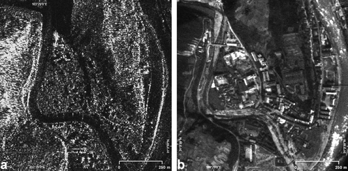
Figure 4. Image examples over Dujiangyan acquired by EROS-B (a), CosmoSkymed stripmap (b), CosmoSkymed spotlight (c), and TerraSAR-X spotlight (d). The subset outlined in (a) is presented enlarged in .
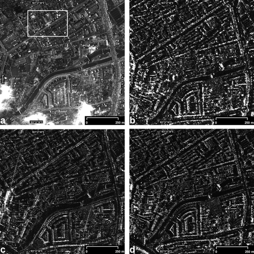
Figure 5. Enlarged subset of the image chips shown in . EROS-B (a), CosmoSkymed stripmap (b), CosmoSkymed spotlight (c), and TerraSAR-X spotlight (d). The damage to the building structure in the central area is well visible on the EROS-B image (a). To a trained interpreter, textural deviations in comparison with intact buildings can serve as an indicator of damage on the spotlight SAR imagery (c, d).
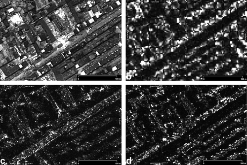
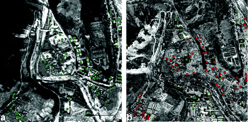
Figure 6. Landslides interrupting roads upstream from Beichuan depicted on a SPOT-5 panchromatic image.
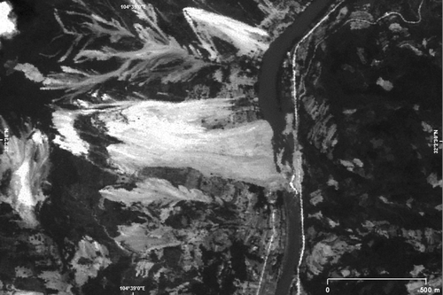
Figure 7. Inundated village as seen on a SPOT-5 panchromatic image.
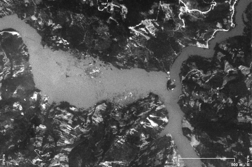
Figure 8. This figure shows the city of Beichuan on pre-disaster (a) and post-disaster (b) SPOT-5 imagery at 2.5 m resolution. Two large landslides (white arrows) have destroyed parts of the city.

Figure 9. Pre-disaster SPOT-5 (a) and post-disaster WorldView-1 (b) imagery over Yingxiu. The green circles on both image chips represent detected intact buildings; those that were destroyed during the earthquake are marked with a red×on the post-disaster image. Intact buildings, identified on the post-disaster WorldView-1 data, but not present on the SPOT image, acquired in 2005, are depicted as light green triangles. The image is centred on 31°04′N, 103°29′E.