Figures & data
Figure 1. The level of interoperability that GeoSciML is designed to address.
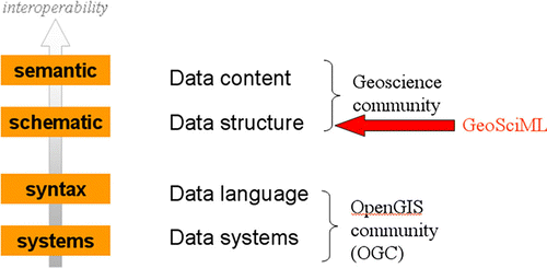
Figure 2. OneGeology-Europe architecture overview.
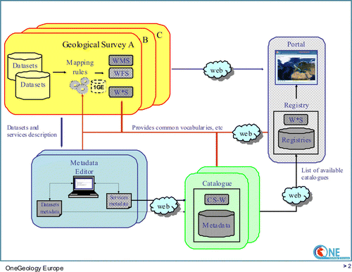
Figure 3. Web interface of the OneGeology-Europe metadata catalogue: addition of a record.
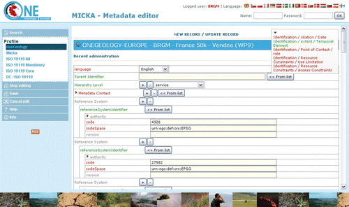
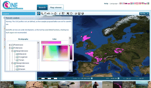
Figure 4. OneGeology-Europe portal with the harmonised geological map of Europe.
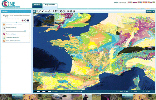
Figure 5. Interoperability used to display only some geologic units.