Figures & data
Table 1. Sources of standards requirements for g2/SDI and SOSI.
Figure 1. SOSI servers in Member States and at European Agencies.
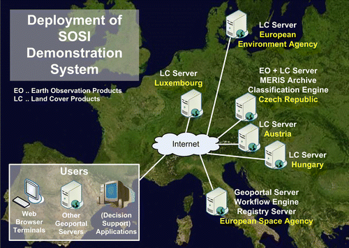
Figure 2. Integration of SOSI Demonstration System into g2/SDI implementation.
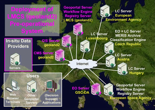
Figure 3. SOSI Service Metamodel.
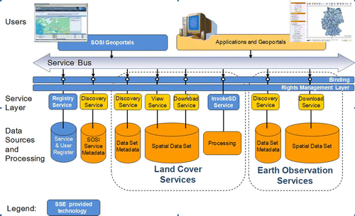
Table 2. SOSI services.
Figure 4. SOSI Software and Web Protocols.
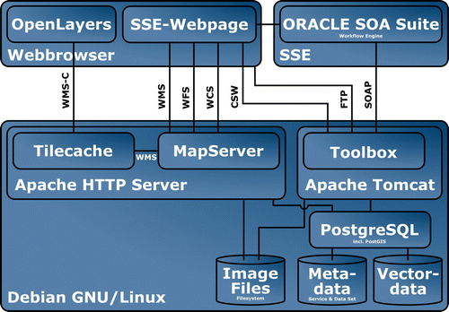
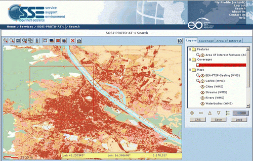
Figure 5. SOSI Geoportal Supporting Product and service discovery, Versatile Area of Interest Definition, WMS-based viewing and WCS-based downloading.