Figures & data
Figure 1. Web search analogy to SDI components (metadata, data and services).
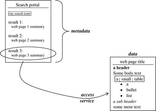
Figure 2. Geogle portal with ‘temperature’ search.
Figure 3. Results of search for ‘temperature’, based on ISO 19115 metadata elements.
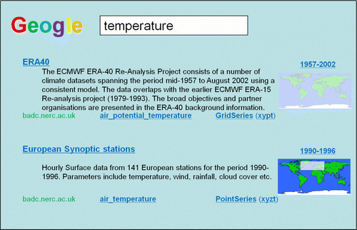
Figure 4. Visual presentation of ISO 19115 spatiotemporal extent (EX_Extent) elements.
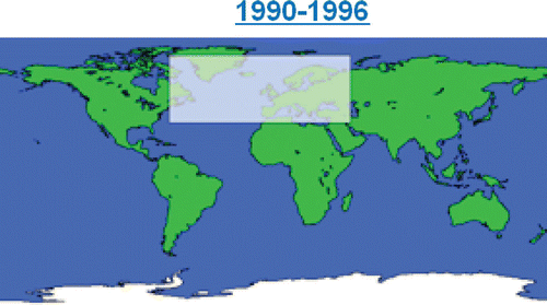
Figure 5. Thesaurus terms referenced from ISO 19115 keywords.
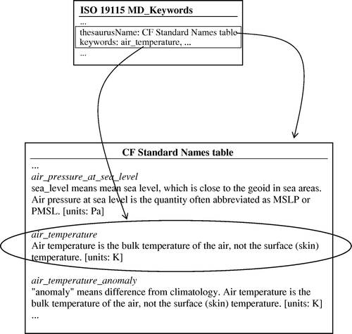
Figure 6. ISO 19115 descriptive keywords and coordinate reference systems displayed in search portal.
Figure 7. Following ISO 19109, UML is used as the formal model for defining feature types. In this case a RadioSondeProfile is defined by attributes for location, time of release, maximum altitude, and measured temperature values. It is released by one or more observers who have a name, and work for some organisation.
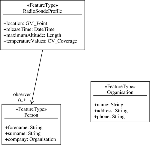
Figure 8. List of feature types, with link to relevant feature catalogue.
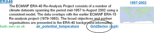
Figure 9. Copying data access endpoint to client software.
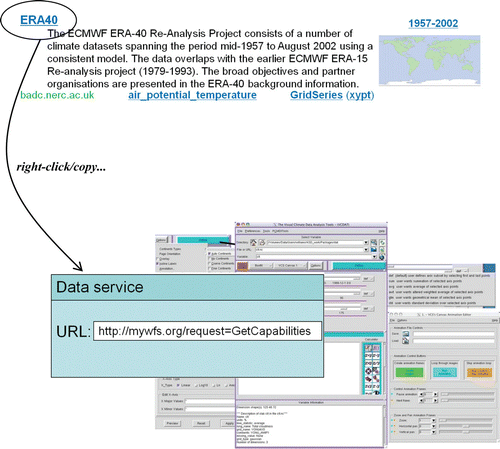
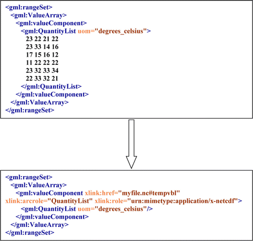
Figure 10. Using xlink to replace in-line GML with an ‘interoperability layer’ over a binary file.