Figures & data
Figure 1. (a) Flood and dike breach scenario tool: determining the dike breach location. (b) Flood and dike breach scenario tool: simulation results.
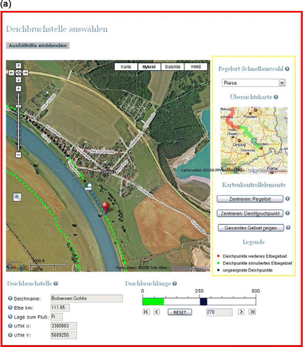
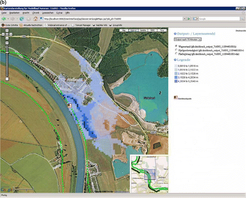
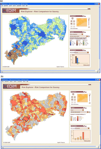
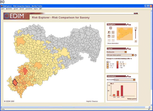
Figure 2. (a) Risk comparison tool: comparison of all existing hazards. (b) Risk comparison tool: comparison of the risk of flood with a 200 year return period. (c) Risk comparison tool: comparison of the risk of earthquake with a 200 year return period.