Figures & data
Table 1. Common wireless communication standards (Glabsch et al. 2009).
Figure 1. Typical results for code-based autonomous positioning SPS (green, µBlox LEA-4T) and code-based differential positioning DGPS (blue, Novatel Smart Antenna V1G). For technical specifications of the receivers LEA-4T and V1G see . Depicted are the variations with respect to true values over a period of almost half an hour. Recording frequency was 1 Hz.
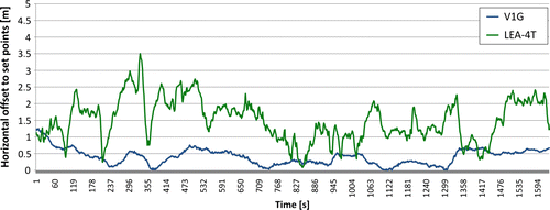
Figure 2. Sky plot for an exemplary period of 1 hour in 2009 at the Bavarian Alps with a typical shadowing situation. In blue the GPS SVs are depicted, in green the Glonass and in red future Galileo satellites.
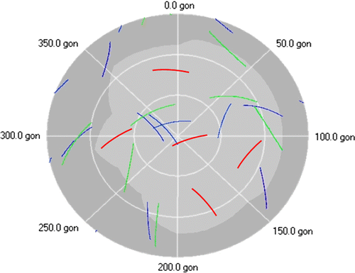
Figure 3. Schematic configuration of the GSN Aggenalm landslide. Main intention is testing recently developed new measuring techniques under field conditions. The new measuring techniques are combined to a GSN with wire-line and wireless communication on site and a remote access via SkyDSL. The onsite computer center (base station) is located at an Alpine hut with 220 V power connection.
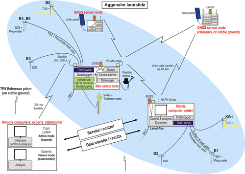
Table 2. Specifications of selected GNSS sensor types.
Figure 4. Work flow GeoSN-UniBw (Glabsch et al. 2009). The central control application comprises of four modular steps, external programs can be embedded.
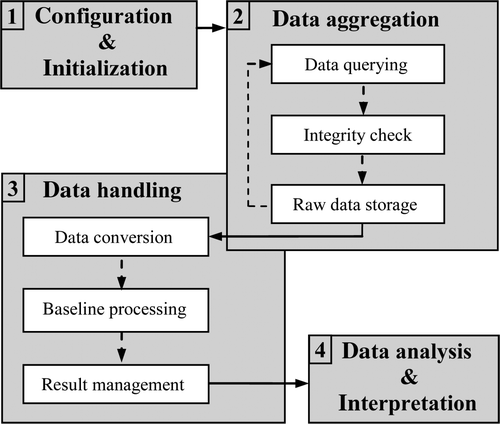
Figure 5. Winter conditions at Aggenalm landslide. On the left picture the GNSS sensor and weather station at the main sensor node is to be seen, the right picture shows the GNSS sensor and the autarkic power supply via solar panel of another sensor node.
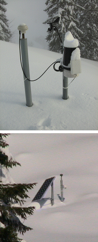
Figure 6. Raw GNSS results from the baseline processor (February–July 2009). Depicted are the time series for horizontal coordinates X (green), Y (blue) and the height (red) for every 15 minutes. Some blunders and gaps are to be seen. The used sensor is a Novatel Smart Antenna.
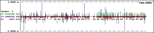
Figure 7. Variations of the horizontal position during a representative day. Depicted are again the 15 minutes results where all outliers are eliminated and the gaps are closed.
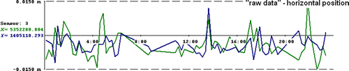
Figure 8. Variations of the horizontal position during a representative day using a moving average filter of 1 hour.
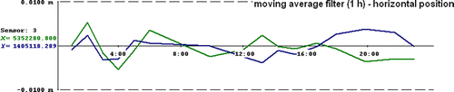
Figure 9. Medium-term trend (moving average filter of 6 hours between February and July 2009). Even movements of a few millimeters are quite clearly seen.
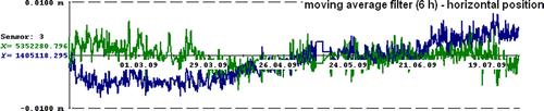
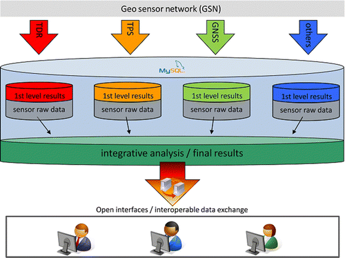
Figure 10. Database at Aggenalm landslide. Open standardized interfaces allow interoperable data exchange of the so called 1st level results individually for the different sensor types or as well the final results from the integrative analysis.