Figures & data
Table 1. The index system of regional vulnerability of hazard-affected bodies.
Table 2. Potential vulnerability factors of different land-use types and disasters.
Figure 1. An area of 100×100 m grid of land-use type maps.
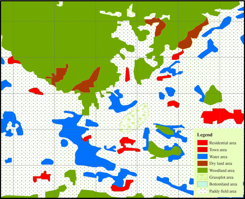
Figure 2. Schematic diagram of a single-grid unit.
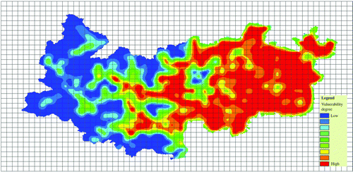
Figure 3. Distribution of the vulnerability of socio-economic factors.
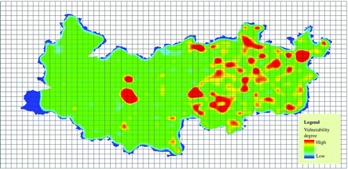
Figure 4. Distribution of the vulnerability of population elements.
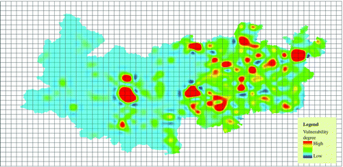
Figure 5. Distribution of the land-use types.
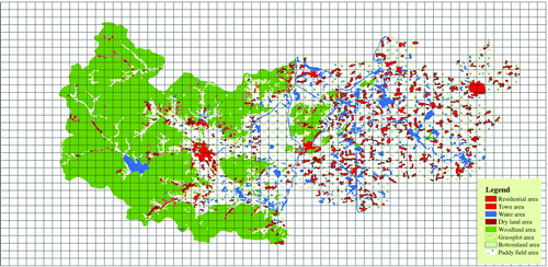
Figure 6. The distribution of the vulnerability of hazard-affected bodies in regional typhoon disasters.