Figures & data
Figure 1. Beichuan County Town of Wenchuan earthquake area in May 2008. Left: oblique photo before the earthquake; Right: 3-D airborne remote-sensing image after the earthquake.
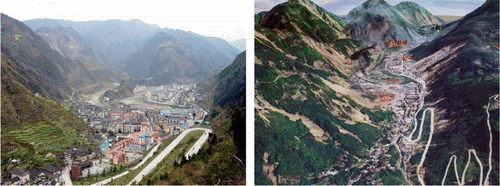
Figure 2. Image/Map of spatial distribution of collapsed buildings interpreted from airborne optical remote-sensing image overlaid with inducing factors generated in April 2010 for the Yushu earthquake area in western China (Guo et al. Citation2010b).
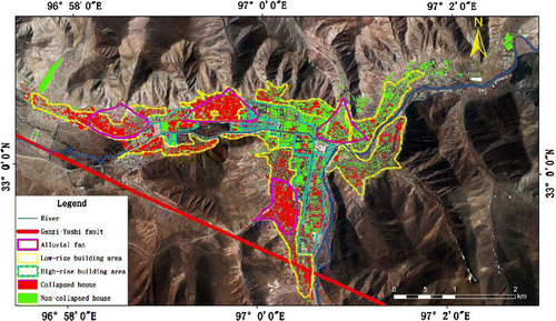
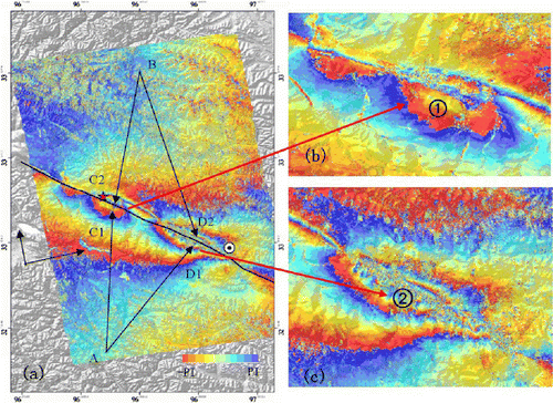
Figure 3. Co-seismic deformation map from ALOS/PALSAR data of Yushu earthquake area in April 2010, where (a) shows differential interferometric phase map; (b) differential interferometric phase of instrumental epicenter; and (c) differential interferometricphase of macro epicenter.