Figures & data
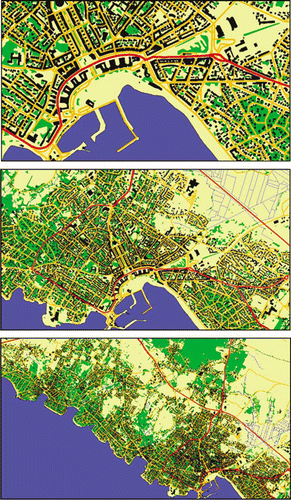
Figure 1. Efficient map design process. In bold, the stages on which this paper focuses.
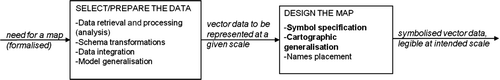
Figure 2. Interface of the CARTABLE prototype (Hubert and Ruas Citation2003). The user is prompted to select the generalisations he likes.
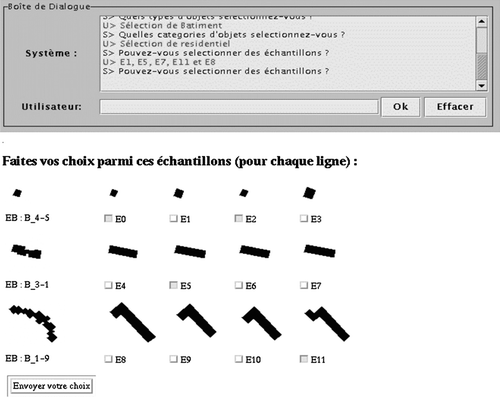
Figure 3. The micro and meso levels of analysis, as proposed by Ruas (Citation2000).
Figure 4. (a) Reference evolution function for a property that should be maintained (expected final value = initial value); (b) How the deviation from the expected value is interpreted in terms of quality. Pictures after Bard and Ruas (Citation2004). With kind permission from Springer Science+Business Media. Developments in spatial data handling, Why and how evaluating generalised data?, 2004, 327–342, S. Bard and A. Ruas.
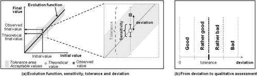
Figure 5. Two measures that contribute to assess spatial distribution preservation: (a) number of free spaces inside a block (from Bard 2004, p. 170): initial state (left) and how it changes after a good (middle) and bad (right) generalisation; (b) presence of buildings in the corner of a block (from Taillandier 2008, p. 379).
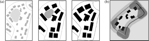
Figure 6. Chromatic circle: (a) distorted to take into account hue; (b) and value; (c) contrast values, after Buard and Ruas (Citation2009). Reprinted with permission. Buard, E. and Ruas, A., 2007. Evaluation of colour contrasts by means of expert knowledge for on-demand mapping. In, Proceedings, 23rd International Cartographic Conference, 4–10 August, Moscow, Russia. © International Cartographic Association (ICA), ISBN: 978-5-9901203-1-0.
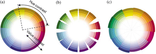
Figure 7. Improvement of symbol specification by MAS from Buard and Ruas (Citation2009). Reprinted with permission. Buard, E. and Ruas, A. 2009. Processes for improving the colours of topographic maps in the context of map-on-demand. In, Proceedings, 24th International Cartographic Conference, Santiago de Chile. © International Cartographic Association (ICA), ISBN: 978-1-907075-02-5.
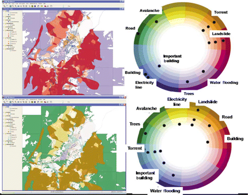
Figure 8. Colours specification based on map samples with the prototype COLLEG (Christophe 2009).
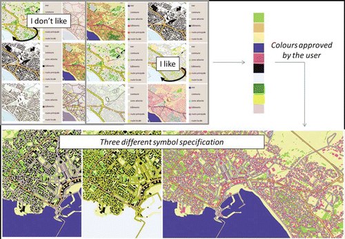
Figure 9. Different approaches from C OGIT laboratory to build and improve symbol specification.
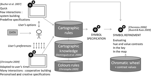
Figure 10. Variation of the balance between quantities of objects and colours depending on map extent.