Figures & data
Figure 1. Map subsets. (a) Building footprint map; gridded built-up maps at different spatial resolutions: 12.5×12.5 m (b); 25×25 m (c); 50×5 0 m (d); and 100×100 m (e). Gridded built-up is shown in light grey and the building footprints from which the gridded built-up is derived is shown in black.
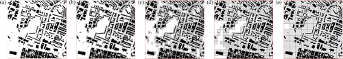
Figure 2. The figure shows two different spatial patterns for four building footprints in a given space. The building footprints are represented in black, while the gridded built-up area at the different sizes, 12.5×12.5, 25×25, 50×50, and 100×100 m, are represented in scale from light to dark grey.
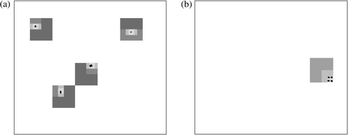
Figure 3. Scatter plots: MSI distribution in relation to the error at the different gridding size (G100, G50, G25, and G12.5). Outliers are labeled with their MSI value.
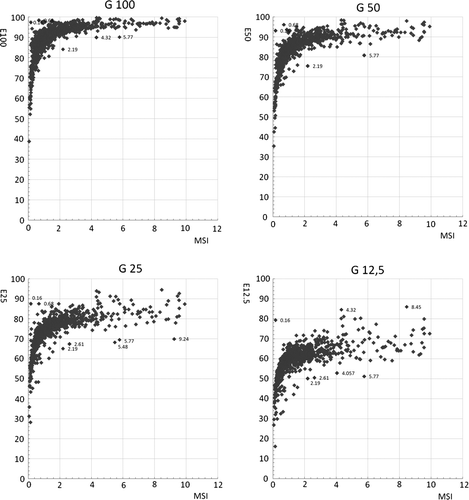
Figure 4. Outlier analysis: (a) MSI = 9.24; (b) MSI = 5.77; (c) MSI = 2.19; and (d) MSI = 0.16.
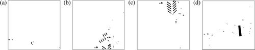
Figure 5. Error map at 1 km2 for each gridding size (12.5, 25, 50, and 100).
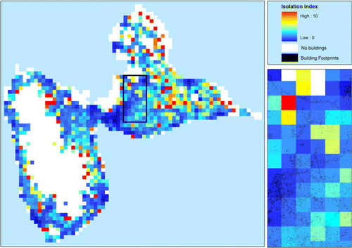
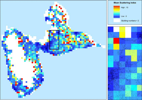
Figure 6. Mean Scattering Index Map: spatial distribution of the MSI at the 1 km2 resolution.