Figures & data
Figure 1. Study areas and airborne remote sensing image coverage for the earthquake area.
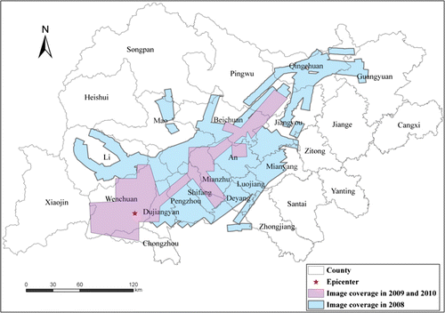
Figure 2. Airborne remote sensing images of Tangjiashan Barrier Lake acquired in 2008, 2009, and 2010, respectively (from left to right).
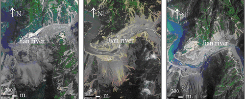
Figure 3. Airborne remote sensing images of original Beichuan County acquired in 2008, 2009, and 2010, respectively (from left to right).
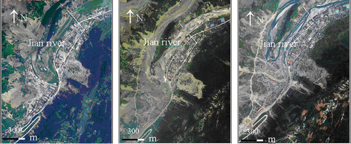
Figure 4. Airborne remote sensing images of Yingxiu County acquired in 2008, 2009, and 2010, respectively (from left to right).
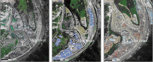
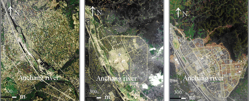
Figure 5. Airborne remote sensing images of new Beichuan County acquired in 2008, 2009, and 2010, respectively (from left to right).