Figures & data
Figure 1. The approach of the HUMBOLDT project to geodata harmonisation with its two-pronged structure made up of a technological side and application momentum converging into the implementation of a Framework architecture.
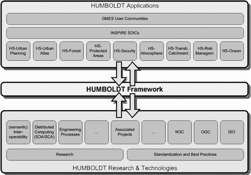
Figure 2. Overview of the HUMBOLDT Framework Components.
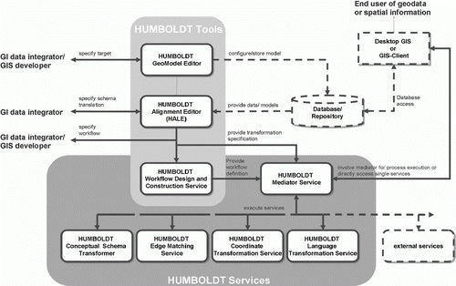
Figure 3. Protected Areas Conceptual Data Model and UML Schema.
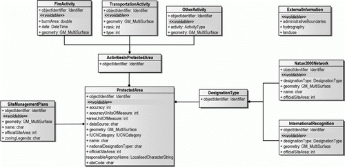
Figure 4. Overview of the HUMBOLDT Framework Components architecture, as utilised in Protected Areas Scenario.
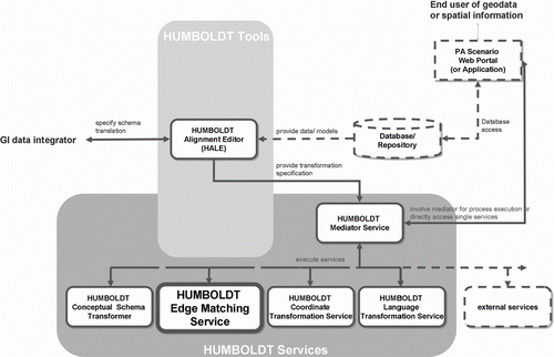
Table 1. Classification of geoinformation users and characteristics in relation to the HUMBOLDT Framework and Protected Areas Scenario.
Table 2. Harmonisation issues and needs in the HUMBOLDT Protected Areas Scenario.
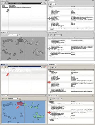
Figure 5. Example of Schema Mapping and Alignment with HALE, based on Protected Areas data models and attributes. The features in the ‘Transformed Data’ view are already transformed using the alignment mapping. For every attribute, you can view what value HALE assigns to them. In the figure you can see how the data structure has changed for the ‘name’ attribute of a given Protected Area. In this case we use the dataset for the Protected Areas (Red de Espacios Naturales) in the Community of Castile and León, in Spain.