Figures & data
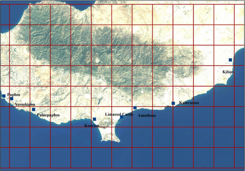
Figure 1. Cultural heritage sites mentioned in the text.
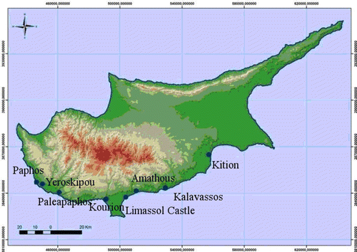
Figure 2. Photos of the CH sites. Data source: http://www.mcw.gov.cy
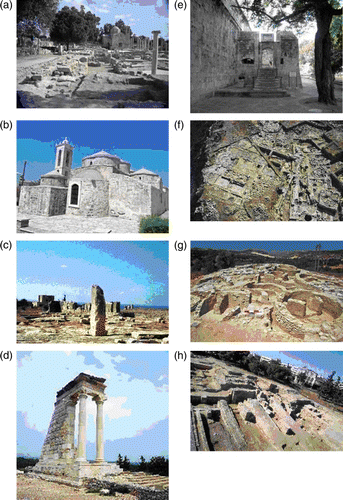
Figure 3. Risk parameters analysed in this paper.
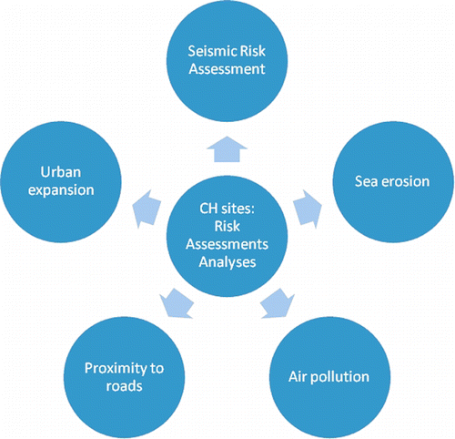
Figure 4. Distribution of earthquakes in Cyprus from the antiquity (2150 B.C.) until 1995. Data Source: Geological Survey Department of Cyprus 1995.
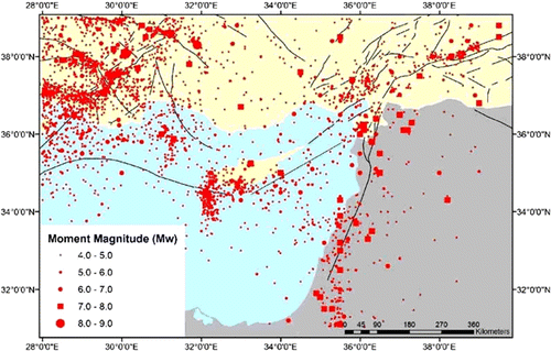
Figure 5. Map showing the seismic hazard for Cyprus. PGA values for the island of Cyprus (percentage of average gravity of earth). Data source: Cyprus Geological Survey.
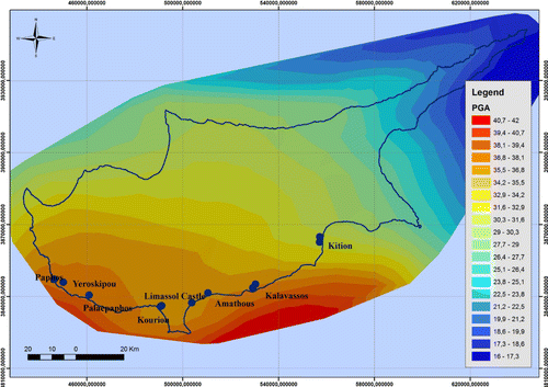
Table 1. List of 15 major seismic events in Cyprus.
Figure 6. Distance of Cultural Heritage Sites from the sea.
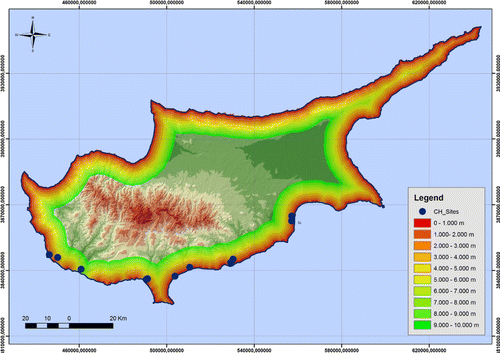
Table 2. Distance of CH sites from the coastline.
Figure 7. Elevation profiles of the archaeological sites from the nearest coastline.
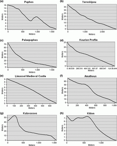
Figure 8. (a) Slope map of Cyprus. (b) Unified geological map of Cyprus.
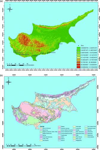
Figure 9. (a) Amathous archaeological site in 1963 CORONA image and 2010 Google Earth. (b) Amathous archaeological site in 2010 Google Earth image. (c) Palaepaphos archaeological site in 1963 CORONA image. (d) Palaepaphos archaeological site in 2004 QuickBird image. (Image © Digital Globe, © 2011 Europa Technologies, © 2011 Google Earth).
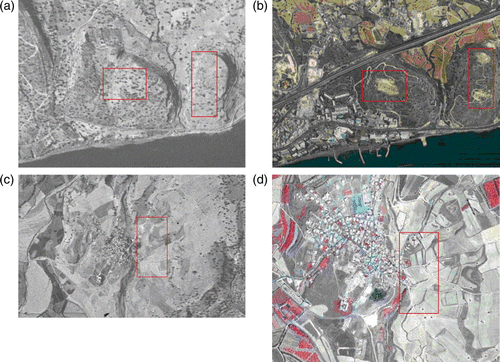
Figure 10. (a) Towns and villages of Cyprus. (b) Proximity of CH sites to urban centres. (c) Comparisons of urban areas for 2000 and 2009. (d) Spatial expansion of urban areas during the last decade.
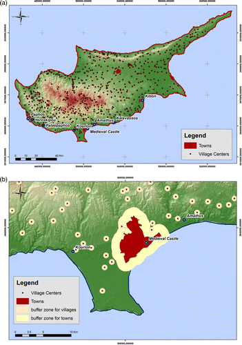
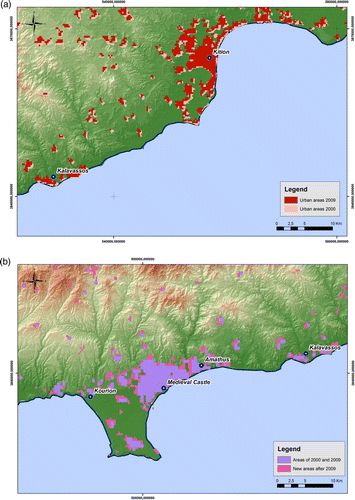
Table 3. Distance of CH sites from urban areas.
Table 4. Urban expansion of Cyprus urban areas during the period of 2002–2009.
Figure 11. (a) Major road network of Cyprus. (b, c) Proximity of CH sites to road network. (d) Classification of road network.
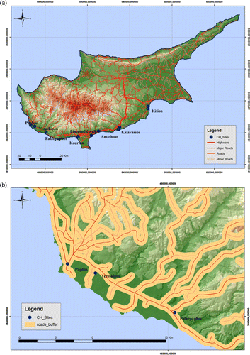
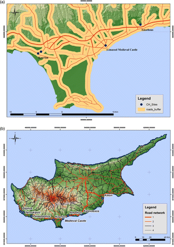
Table 5. Distance of CH sites from the major road network. In brackets the class of the road network is indicated.
Figure 12. Division of Landsat TM in grid cells.