Figures & data
Table 1. Previous studies related to polarimetric decomposition.
Figure 1. Location of the study area.
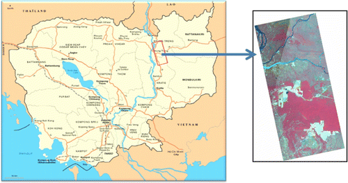
Figure 2. Land cover of the study area.
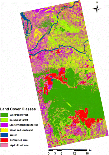
Table 2. Percentage of different types of land cover.
Figure 3. Flow chart of the methodology adopted for polarimetric classification.
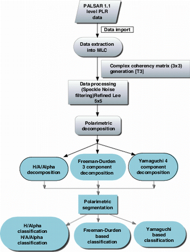
Figure 4. (a) Alpha, (b) entropy, and (c) anisotropy images of PALSAR data.
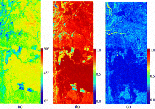
Figure 5. (a) H/A/Alpha (H-Green; A-Red; Alpha-Blue) color image and (b) H/A/Alpha-based land use map (MLC).
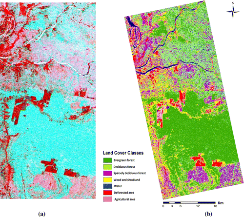
Figure 6. (a) Freeman–Durden three component-based image of PALSAR and (b) Yamaguchi four component-based image of PALSAR (R: double-bounce scattering, G: volume scattering, and B: surface scattering).
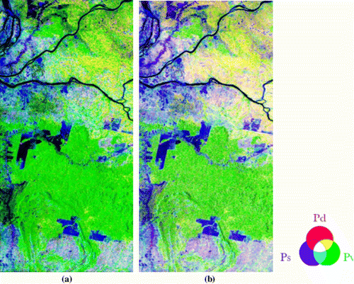
Figure 7. Deciduous forest covered by grass (>50 cm height).
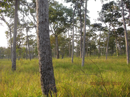
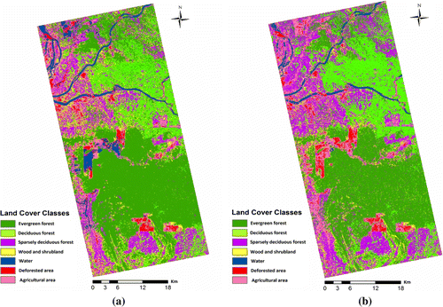
Figure 8. (a) Freeman–Durden three component-based land use map and (b) Yamaguchi four component-based land use map (MLC).