Figures & data
Figure 1. Modern course of the Grand Canal of China. The red line denotes the course of the Grand Canal of China, while the blue lines denote the course of the major natural rivers.
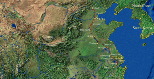
Figure 2. Elevations of cities along the canal. The elevations were extracted from an ASTER Global Digital Elevation Model, produced with 30 m postings, and formatted in 1×1 degree tiles as GeoTIFF files.
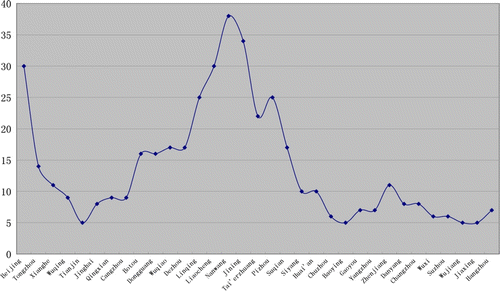
Table 1. Satellite data collected in the project.
Figure 3. Subset from the Radarsat-1 mosaic imagery of the study site. The red ellipse denotes the area with a low backscattering coefficient.
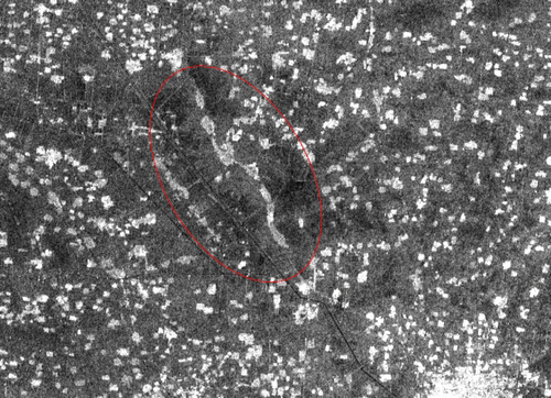
Figure 4. Point density map of the study site. The red ellipse denotes the area of low point density.
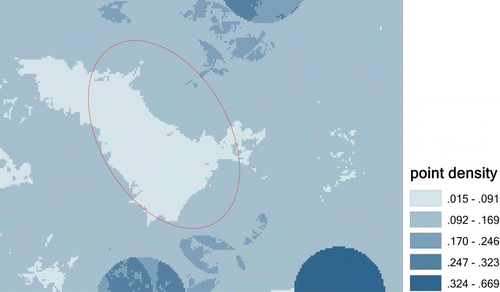
Figure 5. Subset of the Landsat ETM + image of the study site (left) and NDVI map (right). The red ellipse denotes a strong vegetation area, covering almost the same area as the low backscattering coefficient area shown in .
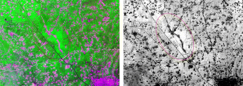
Figure 6. Landsat ETM+ PCA map: upper left, PC2; upper right, PC3; lower left, PC4; lower right, PC5. The red ellipse denotes greater contrast than the surrounding area.
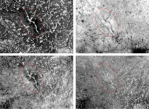
Table 2. Historical materials used in verification of the detection results.
Figure 7. The historic map above shows the location of the disappeared reservoirs. The red ellipse denotes the existence of three reservoirs, Shushan, Mata and Nanwang.
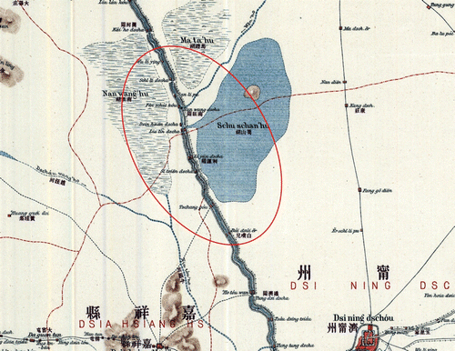
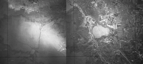
Figure 8. The aerial photo above shows the location of the disappeared reservoirs. It shows that in the 1950s the Nanwang and Mata reservoirs still remained, especially the Nanwang reservoir.