469
Views
4
CrossRef citations to date
0
Altmetric
Original Articles

A Low-Cost Mobile Mapping System (LCMMS) for field data acquisition: a potential use to validate aerial/satellite building damage assessment

, , , , &
Pages 103-123 | Received 06 Apr 2011, Accepted 04 Nov 2011, Published online: 09 Dec 2011

Figures & data

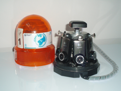
Figure 1. LCMMS system: four webcams and Global Positioning System (GPS) antenna embedded in a beacon light with a magnetic support.

Table 1. Technical features of the PC used in the field test.
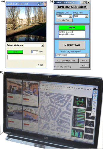
Figure 2. GPS-PC time offset trend (GPS time as reference).
Figure 3. Acquistion software graphical interfaces. (a) Sample grabber, (b) GPS Data Logger, (c) Acquisition windows.
Figure 4. Post-processing software interface.
Figure 5. LCMMS device installed on a WFP car in Port-au-Prince.
Figure 6. LCMMS survey tracks in Port-au-Prince.
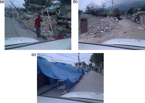
Figure 7. Examples of LCMMS georeferenced frames acquired during the survey. (a) Collapsed building, (b) Restricted road, (c) Temporary shelter.

Table 2. Acquisition survey in Haiti – Statistics.
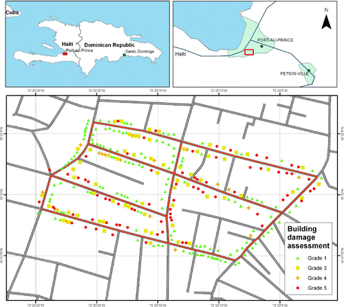
Figure 8. Car survey ground track (red lines) and building damage assessment (based on high-resolution aerial imagery) considered for the validation test.
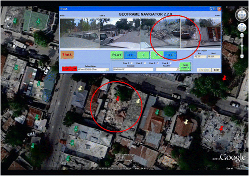
Figure 9. Comparison of a building damage classification on the aerial orthoimage and on the LCMMS frames – Classification agreement example.
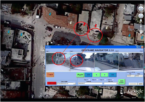
Figure 10. Comparison of a building damage classification on the aerial orthoimage and on the LCMMS frames – Erroneous classification example.

Table 3. Low Cost Mobile Mapping System (LCMMS) vs. aerial assessments confusion matrix.

Reprints and Corporate Permissions

Please note: Selecting permissions does not provide access to the full text of the article, please see our help page How do I view content?

To request a reprint or corporate permissions for this article, please click on the relevant link below:

Academic Permissions

Please note: Selecting permissions does not provide access to the full text of the article, please see our help page How do I view content?

Obtain permissions instantly via Rightslink by clicking on the button below:

If you are unable to obtain permissions via Rightslink, please complete and submit this Permissions form. For more information, please visit our Permissions help page.