328
Views
0
CrossRef citations to date
0
Altmetric
Original Articles

Expeditious management plan towards digital earth

, , , , &
Pages 635-649 | Received 06 Feb 2012, Accepted 23 Nov 2012, Published online: 11 Jan 2013

Figures & data

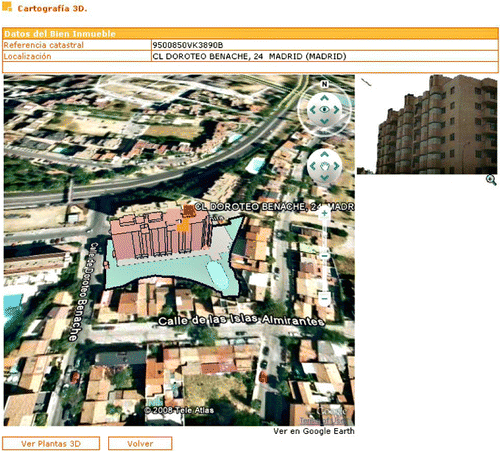
Figure 1. 3D models generated from the cadastral data, displayed on Google Earth (Virgós and Olivares Citation2008).
Figure 2. The schema for forest fire mapping (Naveen and Deepak 2010).
Figure 3. MODIS forest fires data on Google Maps (Naveen and Deepak 2010).
Figure 4. General scheme for expeditious management pattern.

Table 1. Suggested technology for 3D data based on the application requirements (Zhenhua and Ioannis Citation2009).

Table 2. Data sources and various application areas (Omar and Ayhan Citation2009).

Figure 5. Illustrates the stages involved in making the digital earth model.
Figure 6. The 3D model of the Zaragoza city.

Reprints and Corporate Permissions

Please note: Selecting permissions does not provide access to the full text of the article, please see our help page How do I view content?

To request a reprint or corporate permissions for this article, please click on the relevant link below:

Academic Permissions

Please note: Selecting permissions does not provide access to the full text of the article, please see our help page How do I view content?

Obtain permissions instantly via Rightslink by clicking on the button below:

If you are unable to obtain permissions via Rightslink, please complete and submit this Permissions form. For more information, please visit our Permissions help page.