Figures & data
Figure 1. Hierarchical levels of two versions of the Nomenclature X.

Figure 2. NUTS levels. NUTS divisions of the French territory into four levels.
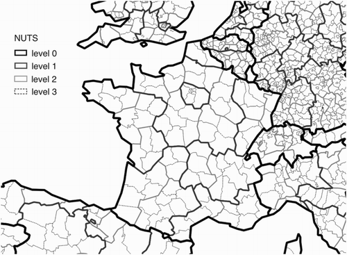
Figure 3. Territorial nomenclatures heterogeneity: example of the NUTS and UMZ nomenclatures.
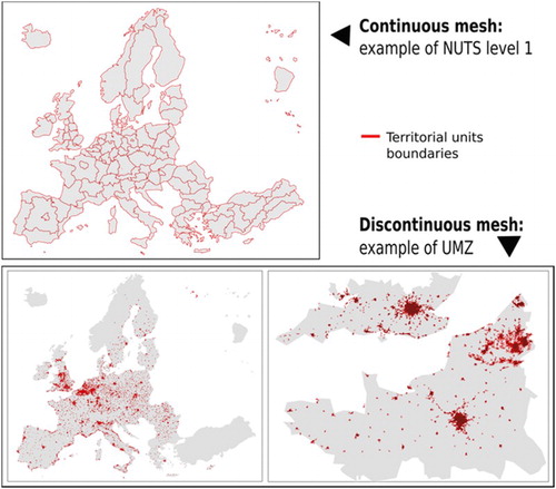
Figure 4. Measured and estimated indicator values, at a same date, considering different territorial division.
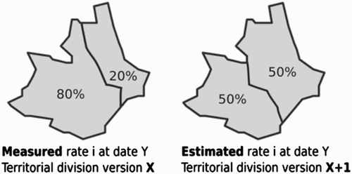
Figure 5. INSPIRE data model extract (Based on: INSPIRE Consolidated UML Model). http://inspire.ec.europa.eu/data-model/approved/r4618-ir/html/
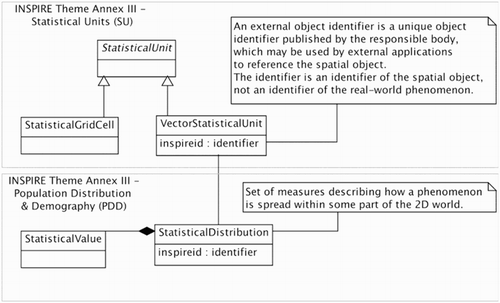
Figure 6. Extract of ESMS (based on: Eurostat Metadata Structure). http://ec.europa.eu/eurostat/data/metadata/metadata-structure
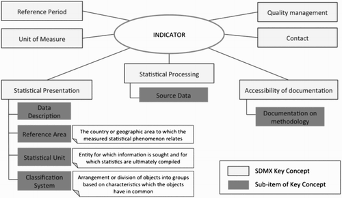
Figure 7. STeDI actors and main use cases.
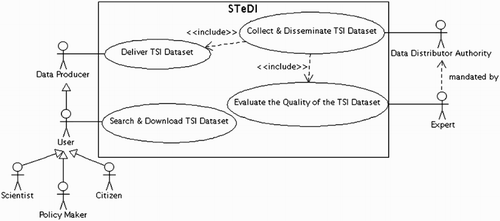
Figure 8. STeDI dataset lifecycle.
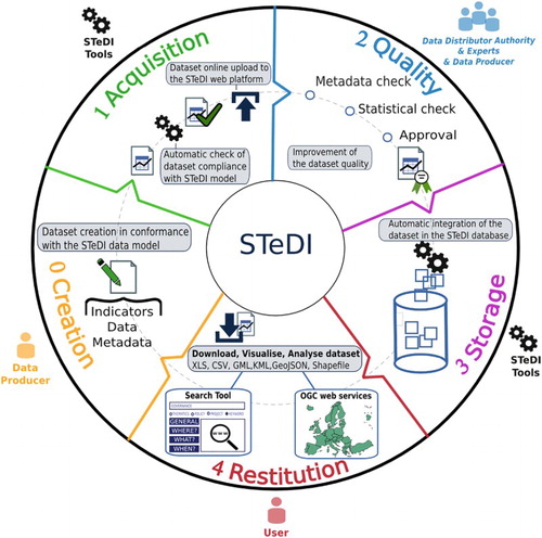
Figure 9. An excerpt of the STeDI model.
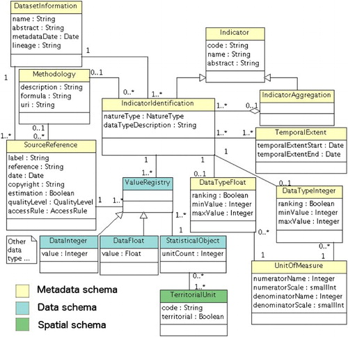
Figure 10. Excerpt of a dataset file compliant with the STeDI model.
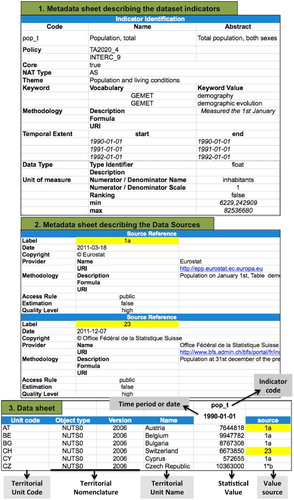
Figure 11. Extract of the STeDI Dictionary of Spatial Unit of the NUTS version 2003. http://database.espon.eu/db2/jsf/DicoSpatialUnits/resource/Nomenclature_NUTS_extended_2003/nomenclature.xls
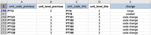
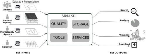
Figure 12. STeDI software components.
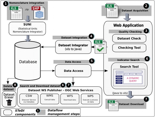
Figure 13. Example of a Quality Process organized via the Checking Tool.
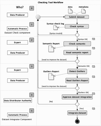
Figure 14. One instantiation of the Checking tool dashboard (ESPON instantiation).
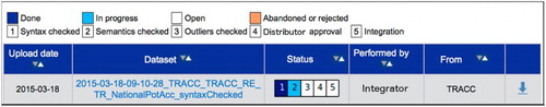
Figure 15. ESPON Database Key Indicator search GUI.
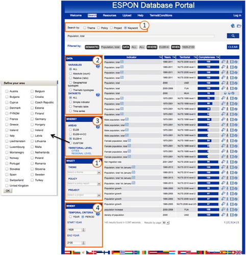
Figure 16. ESPON Database metadata page.
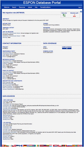
Figure 17. STeDI CSW response to the getRecordById request.
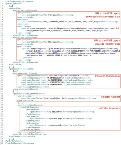
Figure 18. Map created from the ArcGIS client by connecting the STeDI WFS.
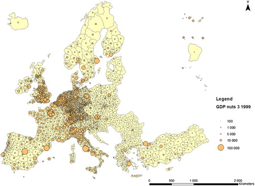
Figure 19. Heterogeneity of TSI processed by STeDI.