Figures & data
Figure 1. LULC map of Dubai Emirate as of 2015 showing the Dubai Creek (Khor of Dubai) divides the Dubai into two parts. The first part is known as Deira (north-east) and the second part is known as Bur Dubai (south-west).
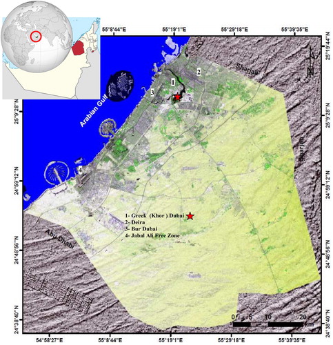
Table 1. Characteristics of Landsat images used in the study area.
Figure 2. Flow chart of method applied to map, monitor and analyse changes from 2000 to 2015 in Dubai.
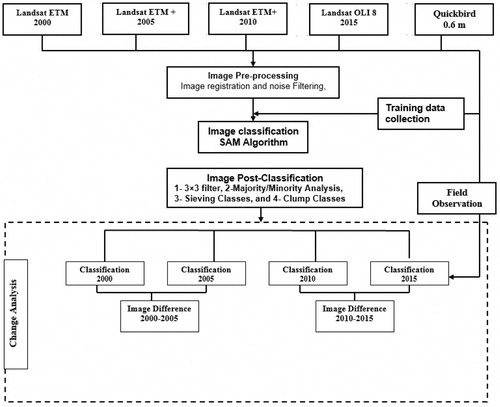
Figure 3. Endmember collection spectra plot showing the reflectivity values and average spectral signature of different classes in the NIR and SWIR portion of the spectrum.
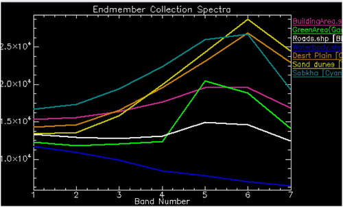
Figure 4. Distribution of a difference function. Significant changes are expected at the tails of the distribution.
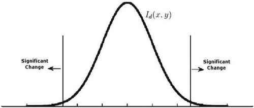
Figure 5. Classification maps derived from Landsat ETM, ETM+ and OLI images using SAM algorithm for the years 2000 (a), 2005 (b), 2010 (c), and 2015 (d).
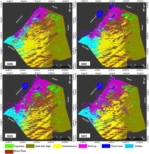
Figure 6. Maps of built-up, water and vegetation at Dubai Emirate as derived from Landsat images using SAM algorithm for the years 2000 (a), 2005 (b), 2010 (c), and 2015 (d).
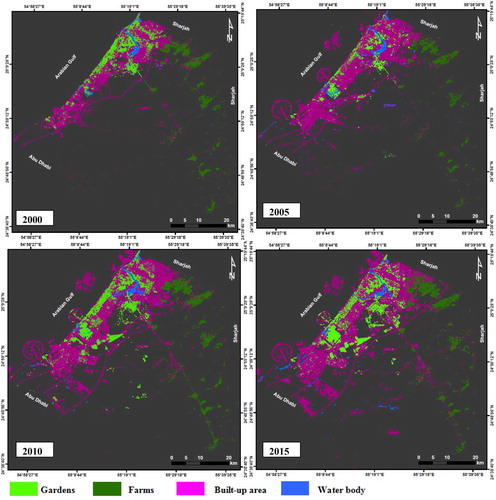
Table 2. Estimates of LU/LC classes total area and percentage and changes from 2000 to 2015.
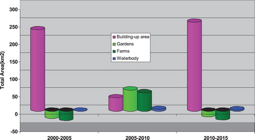
Figure 7. The graphical representation of the built-up, gardens and water body changes from 2000 to 2015.
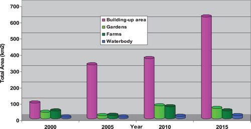
Table 3. Confusion matrix of the year 2000 classification map.
Table 4. Confusion matrix of the year 2005 classification map.
Table 5. Confusion matrix of the year 2010 classification map.
Table 6. Confusion matrix of the year 2015 classification map.
Figure 8. Over all accuracy of each classification map before and after applying post-classification process.
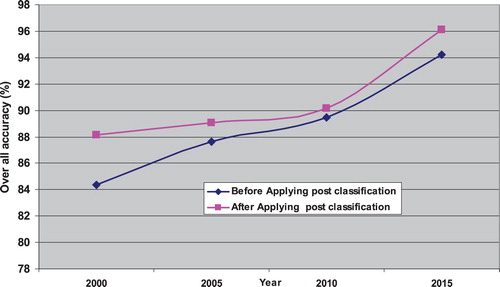
Figure 9. Change detection maps derived from a pair of classification maps using ID algorithm for the years 2000–2005 (a), 2005–2010 (b), 2010–2015 (c), and 2000–2015 (d).
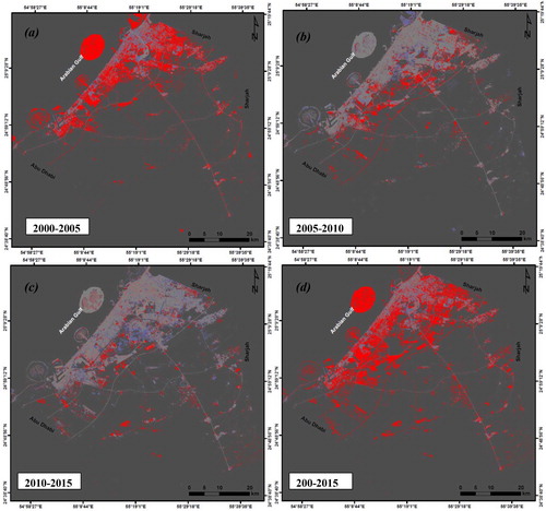
Figure 10. Changes of LU/LC classes calculated from 2000 to 2015.