Figures & data
Figure 1. A modified representation of the reality-virtuality continuum introduced by Milgram et al. (Citation1994).
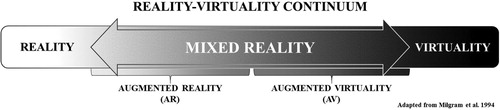
Figure 2. (Top) A real-world view of one of the buildings used in the evacuation analysis (author photo). (Bottom) A 3D re-creation of that building as seen in the VE.
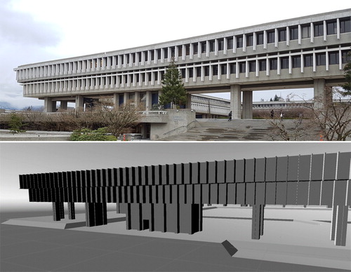
Figure 3. The movement of the AI agents in the simulation is restricted to the navigation mesh (darker grey regions of the floor).
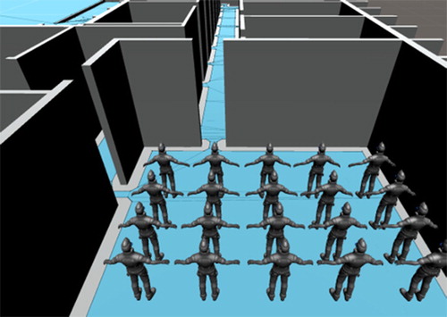
Figure 4. (Main) The AR application recognizes the features of the building and supplements the real world with dynamic, virtual evacuees, providing an opportunity for situated evacuation analysis. (Inset) A view of the tablet being used for situated AR analysis.
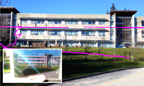
Figure 5. (Left) The AR software has been trained to recognize the features of the building from a photograph. (Middle) When the device’s camera is aimed at the building, the application searches for the features in that photograph. (Right) Once the software has recognized the image, it superimposes the virtual evacuees in the real world.
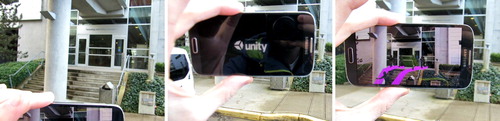
Figure 6. AR allows for situated analysis of virtual human movement in real space. These images depict the application in use, displaying simulated movement of evacuees through one of the 6th floor corridors.
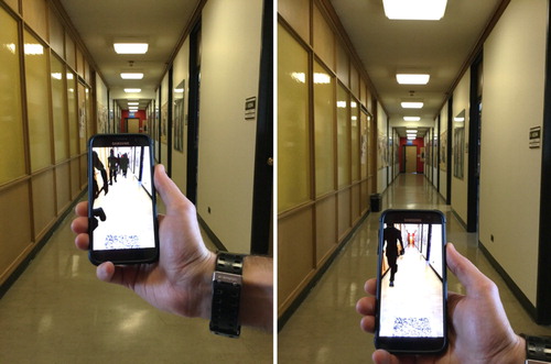
Figure 7. Situated AR analyses can be used to address egress around specific building features (i.e. doorways, benches, garbage cans). In this case, an assessment of the number of people that would travel through a doorway during an evacuation.
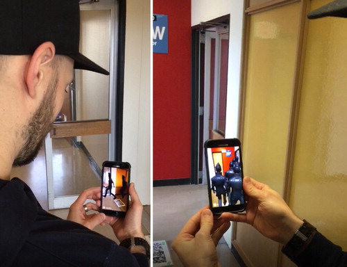
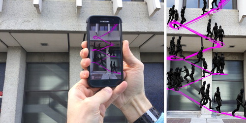
Figure 8. AR image targets can be positioned anywhere, as long as their position in the real world matches their location in the virtual environment. In this instance, the image position on the outside of the building allows for the visual analysis of human movement within it. (Main) A screenshot of virtual evacuees superimposed on the real world. (Inset) The author using the AR application.
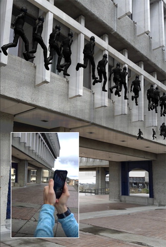
Figure 9. Situated AR can be used to ensure the accuracy of the 3D models used in evacuation analyses. In this instance, the location of a doorway in the architectural drawings does not match the real-world layout of the building; therefore, agents are able to evacuate through a doorway that does not exist. (Left) The author assessing human movement using situated AR. (right) A screenshot of the virtual agents evacuating through a non-existent doorway.