Figures & data
Figure 1. Frequency of keywords in tweets during the flooding events.
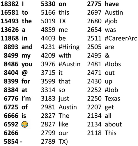
Figure 2. Relationship between the number of Tweets from the @ATXflood channel and the number of flood events in Travis County.
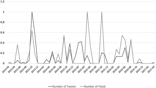
Figure 3. An overview of cyberGIS-enabled MCSDSS.
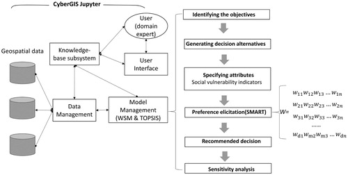
Table 1. Simulated weights for the evaluation criteria in perspectives of two decision goals.
Figure 4. The cyberGIS-enabled MCSDSS user interface.
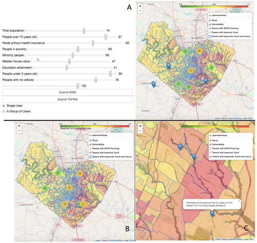
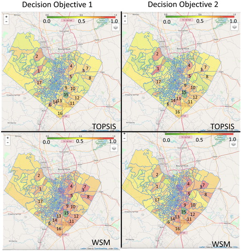
Figure 5. Vulnerability maps based on two decision-making models (WSM and TOPSIS).