
Figures & data
Figure 1. Data download interface of the national geoportal.
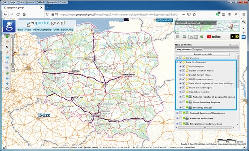
Figure 2. The proposed SDI openness assessment approach.
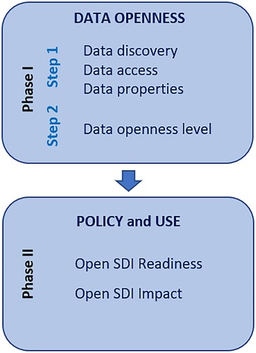
Table 1. Scoring criteria for indicators assessing policy and use.
Table 2. Phase I Step 1: data openness assessment in the PSDI.
Table 3. Phase I Step 2: openness level of the PSDI data available through the main access point.
Figure 3. The number of open data downloads for the period August–December 2020 from the PSDI.
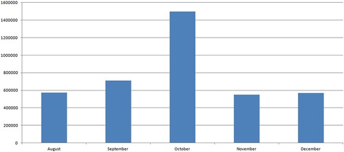
Figure 4. The volume of open data downloads for the period August–December 2020 from the PSDI.
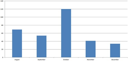
Table 4. Phase II: policy and use.
Data availability statement
The data that support the findings of this study are available from the corresponding author upon reasonable request.