
Figures & data
Figure 1. Framework of the OHDMSM (Open HD Map Service Model).
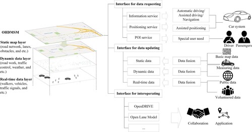
Figure 2. The objects in three layers in the OHDMSM.
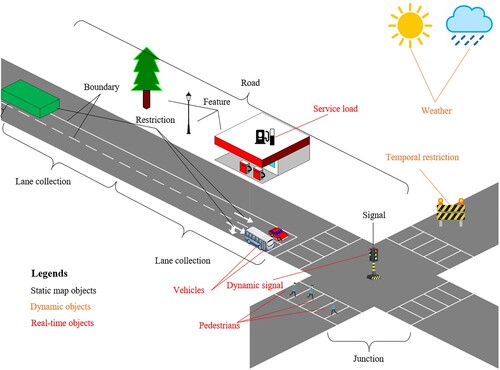
Figure 3. Data structure of the static map layer.
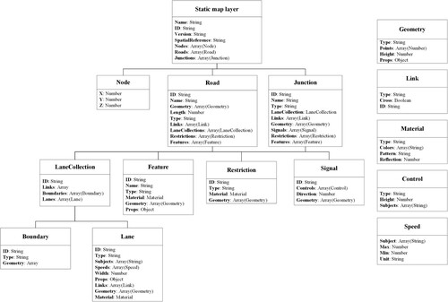
Figure 4. Different road types in the field dictionary.
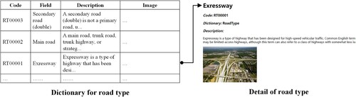
Figure 5. Data structure of the dynamic data layer.
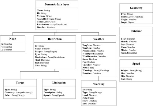
Figure 6. The relationship between restrictions in the dynamic data layer and objects in the static map layer.
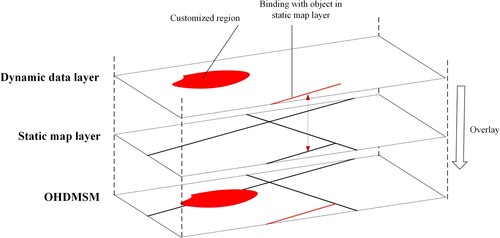
Figure 7. Data structure of the real-time data layer.
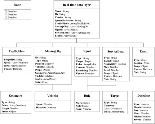
Figure 8. Data requesting from different layers by interfaces.
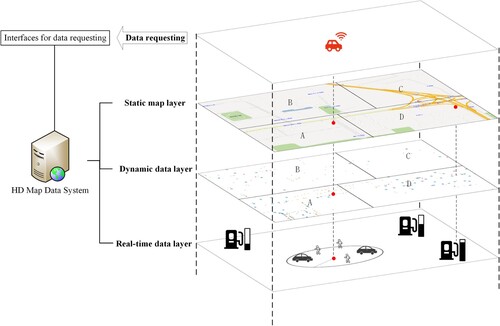
Figure 9. Data updating for layers by interfaces.
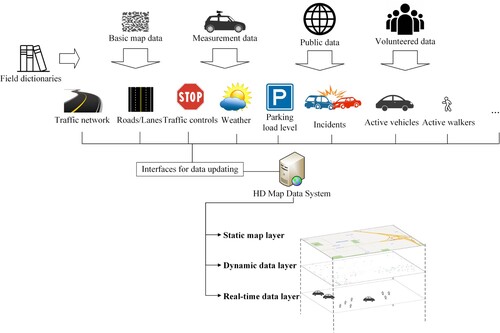
Figure 10. Data interoperation among different data standards or formats by interfaces.
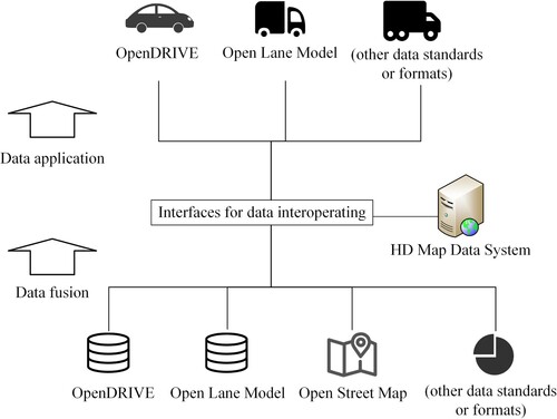
Figure 11. Framework of the HD map system.
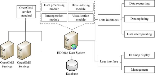
Figure 12. OpenGMS model service for OpenDRIVE data and OSM data conversion to OHDMSM data.
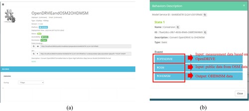
Figure 13. OpenGMS model service for measurement data and OSM conversion to OHDMSM data.
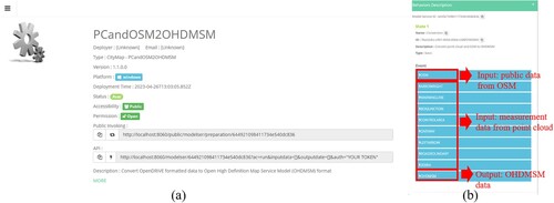
Figure 14. Part of field dictionaries in the system.
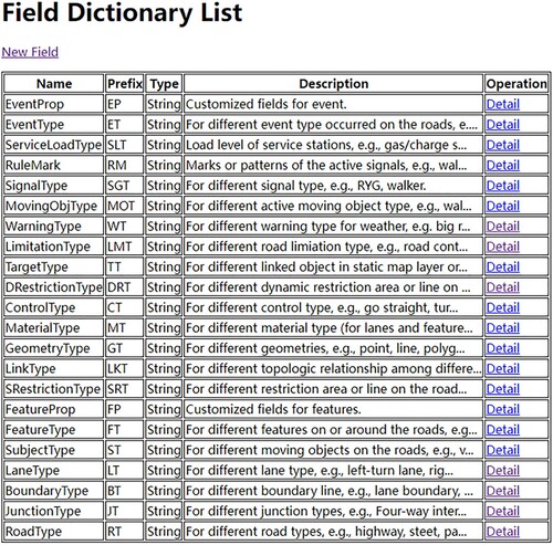
Figure 15. Different road data types in field dictionary.
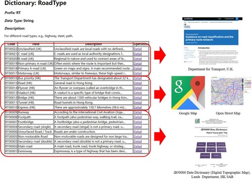
Figure 16. System UI.
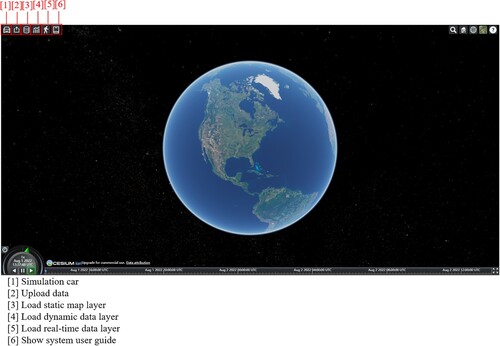
Figure 17. Load data in the static map layer.
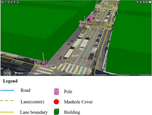
Figure 18. Load data in the dynamic data layer.
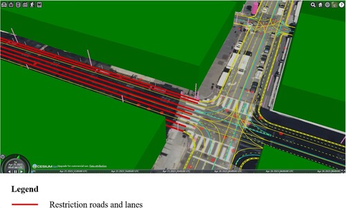
Figure 19. Load data in the real-time data layer.
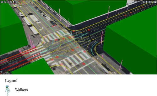
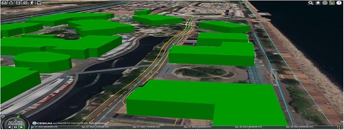
Figure 20. The case study in Hong Kong Science & Technology Parks.
Data availability statement
The data that support the findings of this study are openly available in Science Data Bank (ScienceDB) at http://do i.org/10.57760/sciencedb.03483, reference number 31253.11.sciencedb.03483.