
Figures & data
Table 1. Table for the Review of Representative Documents.
Figure 1. Number of documents published and cited quantity.
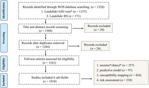
Table 2. Unified terms.
Figure 2. Number of documents published and cited quantity.
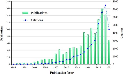
Figure 3. National Geographic visualization with more than 30 articles posted(by VOSviewer and Scimago).
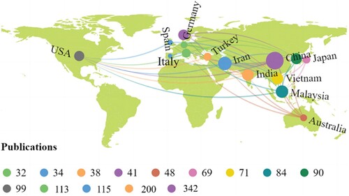
Table 3. Distribution of journals(TOP 5).
Table 4. Highly cited literature information table(TOP 5).
Figure 4. The authors’ partnership is co-present (by CiteSpace).
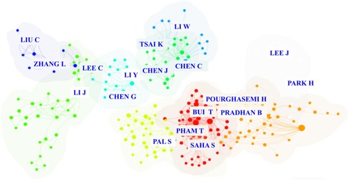
Table 5. High Productivity Authors and Representative Works (Over 30).
Figure 5. Network diagram of cooperation between countries(by VOSviewer ).
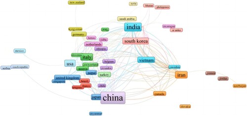
Figure 6. Cooperative analysis and mutation testing (by CiteSpace).
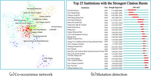
Figure 7. Keywords co-present theme map(by VOSviewer and Pajek).
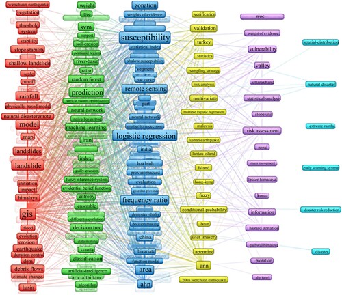
Figure 8. Keyword cluster analysis map (by CiteSpace).
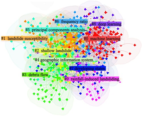
Figure 9. Keyword cluster analysis map (by CiteSpace).
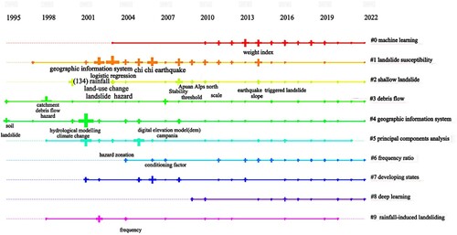
Table 6. Typical Cases of Landslide Detection and Monitoring.
Table 7. Table of Typical Cases of Predictive Models.
Figure 10. Sensitivity mapping to study the heat map(by VOSviewer).
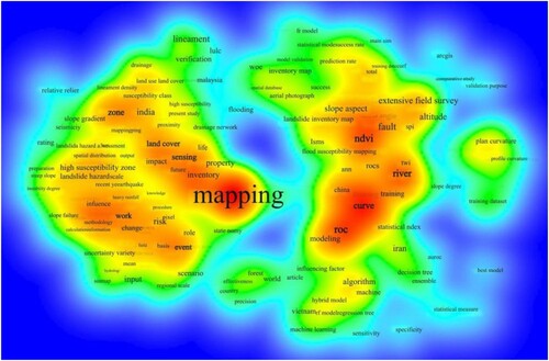
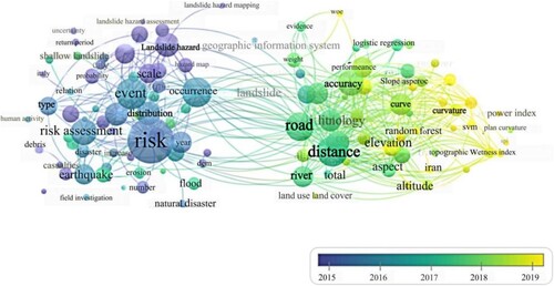
Figure 11. Collinear plot of the risk assessment studies(by VOSviewer).
Data availability statement
The data used in this study are available by contacting the corresponding author.