
Figures & data
Figure 1. Flowchart of the automatic extraction and 3D modeling of real road scenes.
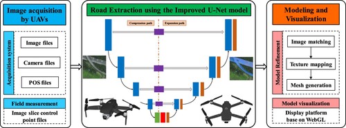
Table 1. Hardware specifications for UAV road image collection.
Figure 2. Road in remote sensing images and its annotation: (a) UAV-acquired, (b) DeepGlobe dataset, and (c) labels.
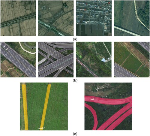
Table 2. Road dataset information in UAV images.
Figure 3. Network structure of the original U-Net model.
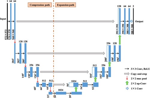
Figure 4. Network structure of the improved U-Net model.
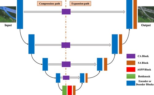
Figure 5. Network structure of coordinate attention mechanism.
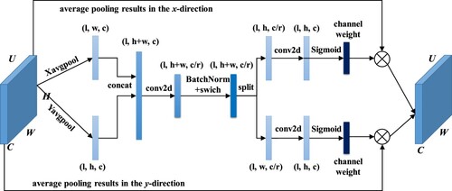
Figure 6. Network structure of SA module.
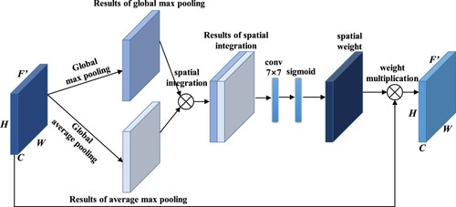
Figure 7. Network structure of the improved ASPP module.
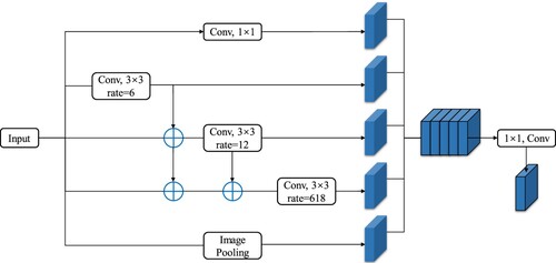
Figure 8. OSGB data format: (a) file structures and (b) organizational form.
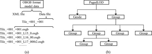
Figure 9. 3D modeling process.
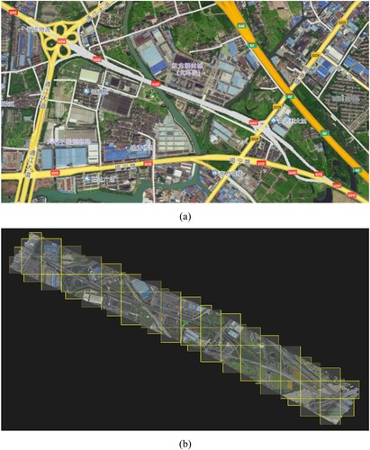
Figure 10. Workflow of the model refinement.
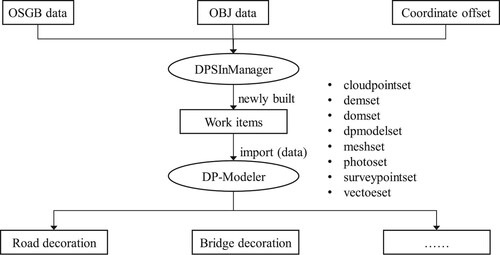
Figure 11. Diagram of the detection results of road extraction for each model.
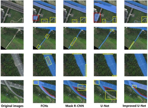
Table 3. Comparisons of the testing results of four road extraction models.
Figure 12. 3D model renderings: (a) global top view and (c) to (d) local details.
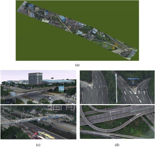
Figure 13. 3D model renderings: (a) global top view and (c) to (d) local details.
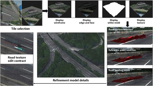
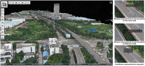
Figure 14. Web-based 3D real-scene highway model using Cesium.
Data availability statement
Data in ) are publicly available and the DeepGlobe road extraction dataset derived from DeepGlobe 2018 (https://www.kaggle.com/datasets/balraj98/deepglobe-road-extraction-dataset). Data in ) were privately acquired and are available on request from the corresponding author.