
Figures & data
Figure 1. Map of Derbyshire (detail), engraved by Thomas Kitchin, after Peter Perez Burdett, 1791 (2nd edition). Derby Museums collection / photo credit: Richard Tailby.
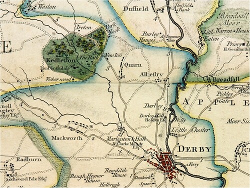
Figure 2. The Sulphur Bathhouse, Kedleston. Image: Author
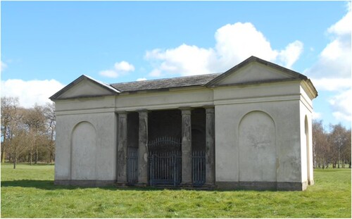
Figure 3. Kedleston Inn. Image: Author
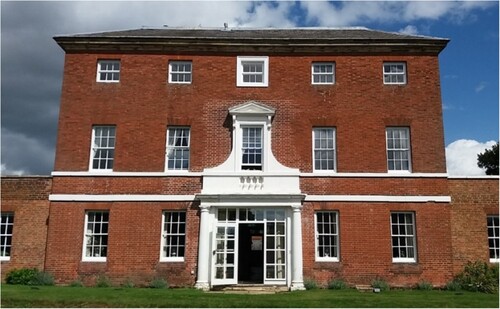
Table 1. Occupations of Kedleston Inn’s proprietors 1841–81. Source: TNA, HO 107/190/5 and HO 107/594/4, 1841 Census; HO 107/2006, 1851 Census; RG 9/1947 and RG 9/2506, 1861 Census; RG 10/3577, 1871 Census; RG11/3408, 1881 Census.
Table 2. Proprietors of Kedleston Inn, 1760–1887. Sources: Derbyshire Record Office, Q/RA 1/1–5, Licensed Victuallers’ Recognisances, 1760–1827; Derby Mercury, 1760–1887.