Figures & data
Figure 1. Map of Southern Ghana showing four shaded districts consisting of the study sites (•). Forest type boundaries are shown by broken line (-----). Forest-type abbreviations: WE = Wet Evergreen; UE = Upland Evergreen; ME = Moist Evergreen; MSSE = Moist Semi-deciduous; NW = Northwest subtype; SE = Southeast subtype; DS = Dry Semi-deciduous; FZ = Fire Zone subtype; IZ = Inner Zone subtype; SM = Southern Marginal.
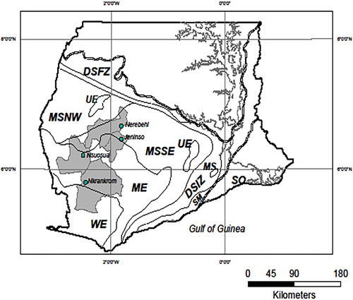
Table 1. Selection of random effects by AICc (Second order Akaike Information Criterion) in a model containing all the fixed effects.
Table 2. Estimates, confidence intervals, p-values and variance components in the selected model.
Figure 2. Observed yields (points) against canopy cover separated over Fertilizer and Training (in the rows) LandUse (in the columns), together with model predictions (lines) from the selected model with Farmsize.
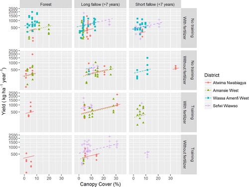
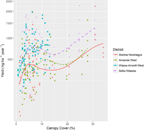
Figure 3. Observed yields (points) against canopy cover designated by districts together with model predictions (lines) from the selected model.