
Figures & data
Figure 1. Map of study area.
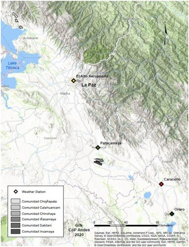
Table 1. Families participating in workshops and interviews.
Table 2. UMALA, Central Altiplano Producer evaluation of the reliability of biological forecast indicators.
Table 3. ANCORAIMES, Northern Altiplano Producer evaluation of the reliability of forecast indicators.
Figure 2. Relationship between frosts and subsequent rainfall in the Central Altiplano.
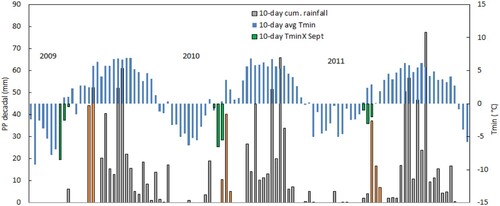
Figure 3. Relationship between frosts and subsequent rainfall in Northern Altiplano.
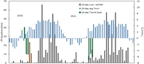
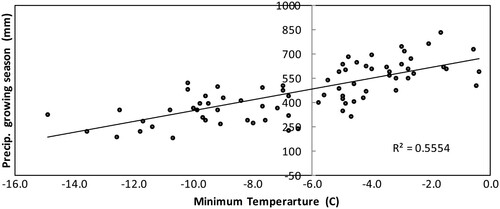
Figure 4. Relationship between the minimum temperature on Fiesta de San Juan and total precipitation for four stations in the Northern and Central Altiplano 1980–2015.
Data availability statement
Historical meteorological data used is available from SEHNAMI (Bolivian national weather service) at http://senamhi.gob.bo/index.php/inicio; human subject data is subject to confidentiality agreements but those interested may contact Edwin Yucra at [email protected].