
Figures & data
Figure 1. The study area and 222 points of National Institute for Environmental Studies Level 2 data (observations) for March to June 2009–2012.
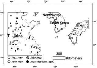
Table 1. Temperate climate zone observed in the study area (Köppen-Geiger climate classifications).
Table 2. Basic statistics for Level 2 XCO2 data with values ranging from 382.1 to 395.22 ppm.
Table 3. Summary statistics for the root mean square prediction error for original (observed) and predicted values (ppm).
Figure 2. Distribution of the kriging prediction error for XCO2 data.
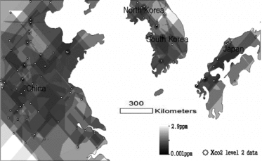
Figure 3. National Institute for Environmental Studies Level 3 product of XCO2 estimates (unit: ppm) for March to June 2009–2012.
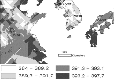
Table 4. Summary statistics for XCO2 concentration values after Kriging, and geographic information system zonal statistics (ppm).
Figure 4. Level 3 XCO2 concentrations (unit: ppm) for first-level administrative regions (provinces and states) with a temperate climate in Northeast Asia.
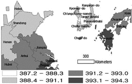
Table 5. Five administrative regions with the highest and lowest XCO2 concentration levels, ranging from 387.2 to 394.3 ppm.