Figures & data
Figure 1. Annual methane emissions for the PIH (upper graph), the glacial changes (LGM minus PIH; second graph), emissions from PIH wetlands that were covered by ice during the LGM (third graph) and from LGM wetlands on continental shelves that were inundated during the PIH (lower graph) for eight different models. Emissions are integrated zonally and by 10° latitude belts.
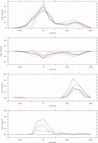
Table 1. The PIH and LGM simulations included in the analysis, their type (atmosphere-ocean or atmosphere-ocean-vegetation), and the annual methane emissions from wetlands (in Tg) during the PIH and the LGM estimated from each model.
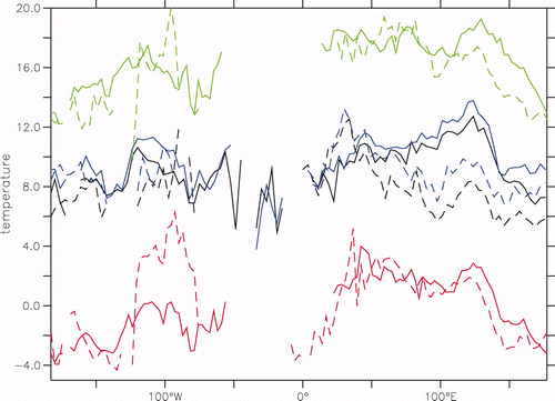
Figure 2. The mean temperature during the emission season, latitudinally averaged over latitudes 30–90° N, for the PIH (solid lines) and the LGM (dashed lines) in four PMIP2 simulations: CCSM3.0 (red: offset by −5°C), HadCMsM2 (black), HadCM3M2-TRIFFID (blue) and MIROC3.2.2 (green, offset by + 8°C).