Figures & data
Figure 1. General map of the Windward Islands of the Lesser Antilles and the Guianas indicating the locations of Argyle (Saint Vincent), Amotopo (Surinam), and Maillard (French Guiana). (Drawing by Menno L.P. Hoogland).
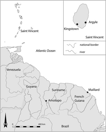
Figure 2. Map indicating the location of Argyle, Saint Vincent. (Drawing by Menno L.P. Hoogland).
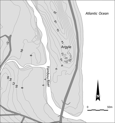
Table 1. Radiocarbon dates of two postholes at the Argyle site.
Figure 3. Top view and cross-sections of the reconstructed Island Carib or Kalinago táboüi (men’s house). The reconstruction is based on the archaeological floor plan at Argyle and the description of the building elements by Breton (Citation1999). (Drawing by Menno L.P. Hoogland).
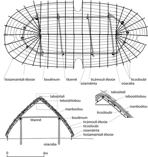
Figure 4. Geographical map of the environment of Maillard village, Commune de Macouria, French Guiana. (Drawing by Menno L.P. Hoogland after regional map by the National Geographical Institute IGN).
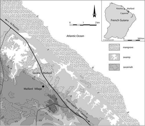
Figure 5. Map of Maillard, French Guiana. (Drawing by Stéphen Rostain).
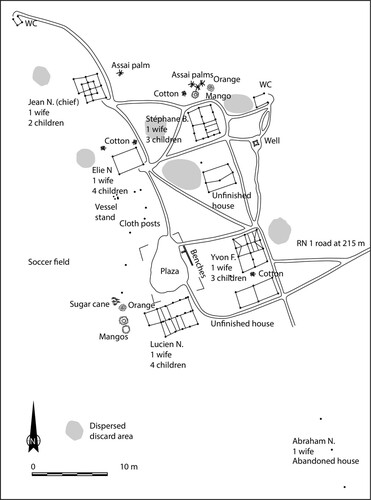
Figure 6. Top: Houses in the village of Maillard, French Guiana, showing various stages of deconstruction and deterioration. (Photo by Stéphen Rostain.) Bottom: Houses at Amotopo, Suriname. (Photo by Jimmy L.J.A. Mans, 2007).
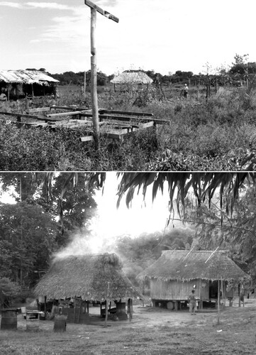
Figure 7. Map of Amotopo, Suriname. (Drawing by Jimmy Mans, adapted by Menno Hoogland).
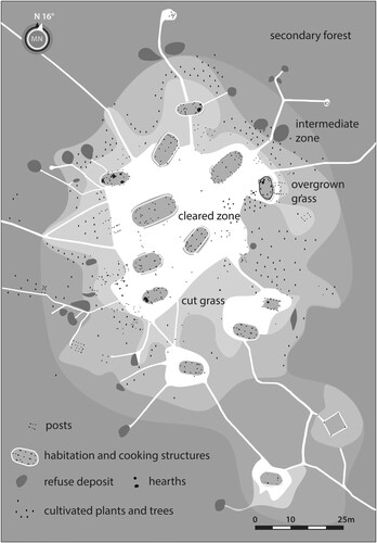
Figure 8. Interpretation of the Argyle settlement, Saint Vincent, based on archaeological data and ethnohistorical information. (Drawing by Menno L.P. Hoogland).
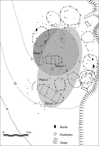
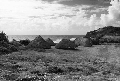
Figure 9. Experimental reconstruction of five houses in the Cayo village of Argyle, Saint Vincent. (Photo by Menno L.P. Hoogland, 2017).